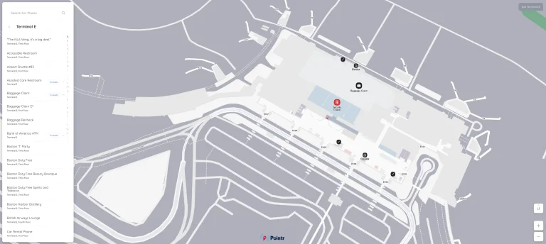
John Wayne Airport Map (Most Up-To-Date)
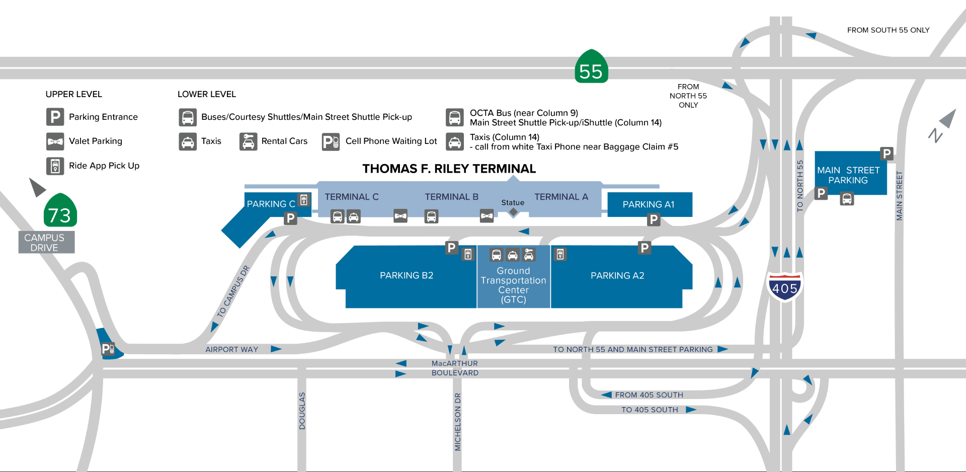
John Wayne Airport’s Thomas F. Riley Terminal runs as one compact, single-building corridor with three administrative zones (A–B–C) laid out in a straight north–south line. Within Orange County’s main air hub, gates connect continuously post-security, while curbside and ground transport split by level: Departures (upper) for ticketing/TSA and Arrivals (lower) for baggage claim. The main “gotcha” is vertical movement to parking-structure rideshare on Level 3.
Map Table
| Terminal | Key Airlines | Primary Function | Transfer Mode |
|---|---|---|---|
| Terminal A (North) | American, Delta, Air Canada, WestJet, Breeze | Gates 1–8 | Airside walk |
| Terminal B (Center) | United, Alaska | Gates 9–15 | Airside walk; landside corridor |
| Terminal C (South) | Southwest, Frontier, Spirit, Allegiant | Gates 16–22; FIS | Airside walk; landside corridor |
John Wayne Airport Map Strategy
- Treat Terminal B and Terminal C security as interchangeable saves: if one TSA line spikes, walk landside along the upper-level ticketing corridor to the other checkpoint before committing to a long queue.
- Rely on the airside advantage: once you clear TSA anywhere (A/B/C), the post-security concourse stays continuous to Gates 1–22 without re-clearing.
- Plan rideshare as a parking-structure mission, not a curb pickup: Terminal B uses Parking Structure B2 Level 3; Terminal C uses Parking Structure C on the upper/Level 3 area near ticketing and the elevators.
- Use level choice to beat congestion: private pickup/drop-off works best on the upper (Departures) level after the morning rush, while arrivals curbside stays crowded and does not work for app-based rideshare.
2026 John Wayne Airport Map + Printable PDF
Current Riley Terminal operations keep the same “one concourse, three zones” layout, so the most important map detail is still level logic: ticketing and TSA upstairs, baggage claim downstairs, and Uber/Lyft pickup moved off-curb into parking structures (typically Level 3). Printing a 2026 map helps most when you’re choosing an alternate checkpoint fast or trying to reach the correct rideshare garage level without backtracking.
2026 John Wayne Airport Map Guide
What is the exact walking distance (feet/meters) from Terminal C ticketing to the nearest TSA checkpoint entrance at John Wayne Airport?
The walking distance is under 200 feet (about 61 meters) from Terminal C ticketing to the Terminal C TSA checkpoint entrance.
Terminal C’s checkpoint sits on the same upper (Departures) level as the Southwest/Frontier/Spirit/Allegiant counters, essentially “adjacent to check-in,” so the walk is typically 30–60 seconds at normal pace. The only practical delay comes from queue spillover: when the Terminal C line extends back toward the ticketing lobby, your “start point” becomes the back of the queue rather than the checkpoint entrance.
After clearing TSA at the Terminal B checkpoint, what is the exact indoor route (named corridors/turns) to reach Terminal C gates without re-clearing security?
No re-clearing security is required because the post-TSA concourse is one continuous sterile hallway from Terminal B into Terminal C.
After you exit the Terminal B checkpoint, you emerge near Gates 10–11. Turn right (south) toward higher gate numbers and follow the main concourse signed for “Gates 15–22.” You’ll pass the central concessions cluster around Gate 12 (McDonald’s/Starbucks), then the B/C seam marked by the shared food cluster around Gates 13–14 (Jamba Juice/OC Pizza/Qdoba). Continue straight into Terminal C, where Gate 16 appears shortly after Gate 15, and keep following the same concourse to reach Gates 17–22 (including 22A/22B/22C at the far south end).
From Terminal B baggage claim, what is the exact path to the standard Uber/Lyft pickup point (which parking structure, which level/roof, and which entrance/elevator core)?
Uber/Lyft pickup for Terminal B is in Parking Structure B2 on Level 3, not at the Terminal B curb.
From Terminal B baggage claim (Arrivals/lower level, near Carousels 3–4), go to the central elevator/escalator core and ride up to the Departures (upper) level. Walk out to the upper curb, then use the pedestrian connection across to Parking Structure B2 where the terminal level aligns with the structure’s Level 3. Once inside B2, follow “Rideshare Pickup” signs toward the Level 3 rideshare area near the Level 3 exit and the Level 3 elevator bank (the elevators are your key anchor—if you’re not on Level 3 by that elevator core, you’re on the wrong floor).
From Terminal C baggage claim, what is the exact path to the rideshare pickup on the Terminal C parking structure roof/top level (including which end of Terminal C you must walk toward before going up)?
Rideshare pickup for Terminal C is in Parking Structure C on the upper/Level 3 area by the Level 3 elevators near ticketing, not at the arrivals curb.
From Terminal C baggage claim (Arrivals/lower level, near Carousels 5–7), take the escalator/elevator up to the Departures (upper) level. Once upstairs, walk toward the ticketing/check-in side of Terminal C (the Southwest counter area is the main landmark), then exit the terminal near the doors that lead directly into Parking Structure C. Inside the structure, use the Level 3 elevator core as your anchor and follow the “Rideshare Pickup” signage to the pickup zone on that upper/top level.
Where are the Terminal B curbside passenger pickup zones located on the Departure/upper level, and what door identifiers (numbers/letters) correspond to those zones?
Terminal B curbside passenger pickup on the upper (Departures) level runs along the Terminal B ticketing frontage, aligned to the same roadway column-number system used on the terminal loop, but specific door IDs for the upper level are not published in the provided audit data.
For precision pickup at Terminal B, use the Terminal B Departures curb directly outside the United/Alaska ticketing area and coordinate by the nearest numbered curbside columns (Terminal B’s numbering reference is Columns 6–10 on the Arrivals level, which typically tracks the same terminal segment on the loop). If you need an app-based ride, do not use the curb at all—Uber/Lyft are geofenced to Parking Structure B2 Level 3.
Where is the Main Street (offsite) parking shuttle terminal drop-off stop for Terminal B, and what is the exact walking distance from that stop to the Terminal B TSA checkpoint entrance?
The Main Street Parking shuttle drops at the Ground Transportation Center on the Arrivals (lower) level between Terminals A and B, not at the Departures curb for Terminal B.
From the GTC stop, walk across the roadway into the Terminal B arrivals core (about 150–200 feet / 46–61 meters), then take the central elevator/escalator up to the Departures (upper) level, and continue to the Terminal B TSA entrance (about 50–100 feet / 15–30 meters more). Combined horizontal walking distance is roughly 200–300 feet (about 61–91 meters), plus the required vertical transition from lower to upper level.
What is the exact walking distance from the Terminal A TSA exit to the nearest concessions cluster located in the B/C area (the spot travelers describe as having “better concessions”)?
The walking distance is roughly 1,000–1,200 feet (about 305–366 meters) from the Terminal A TSA exit to the B/C concessions cluster around Gates 13–15.
After Terminal A security (near Gates 6–7), walk airside south toward higher gate numbers, staying on the main concourse. Use the Gate 12 food/coffee node (McDonald’s/Starbucks) as your mid-point landmark, then continue to the shared B/C seam where Jamba Juice/OC Pizza/Qdoba sit around Gates 13–14, with Taps Fish House and Stella Artois Bar near Gates 15–16 just beyond. At typical pace, this is about a 5–6 minute walk.
If the TSA line at Terminal C is long, what is the exact walking distance from the Terminal C checkpoint queue area to the Terminal B checkpoint queue entrance (the “walk to the next terminal” workaround)?
The walking distance is about 300–500 feet (roughly 91–152 meters) from the Terminal C checkpoint queue area to the Terminal B checkpoint queue entrance along the upper-level landside ticketing corridor.
Start at the Terminal C TSA queue area on the Departures (upper) level and walk north toward the central ticketing blocks, following the continuous indoor landside walkway that links C to B. The Terminal B checkpoint entrance is near the Gate 10/11 access area (center zone). At a brisk pace, the move is typically 1–2 minutes, making checkpoint-hopping a practical save when Terminal C’s line spikes.