New York Stewart International Airport Terminal Map (2025)
Open the New York Stewart International Airport Terminal Map to plan your next trip through this quiet Hudson Valley gateway.
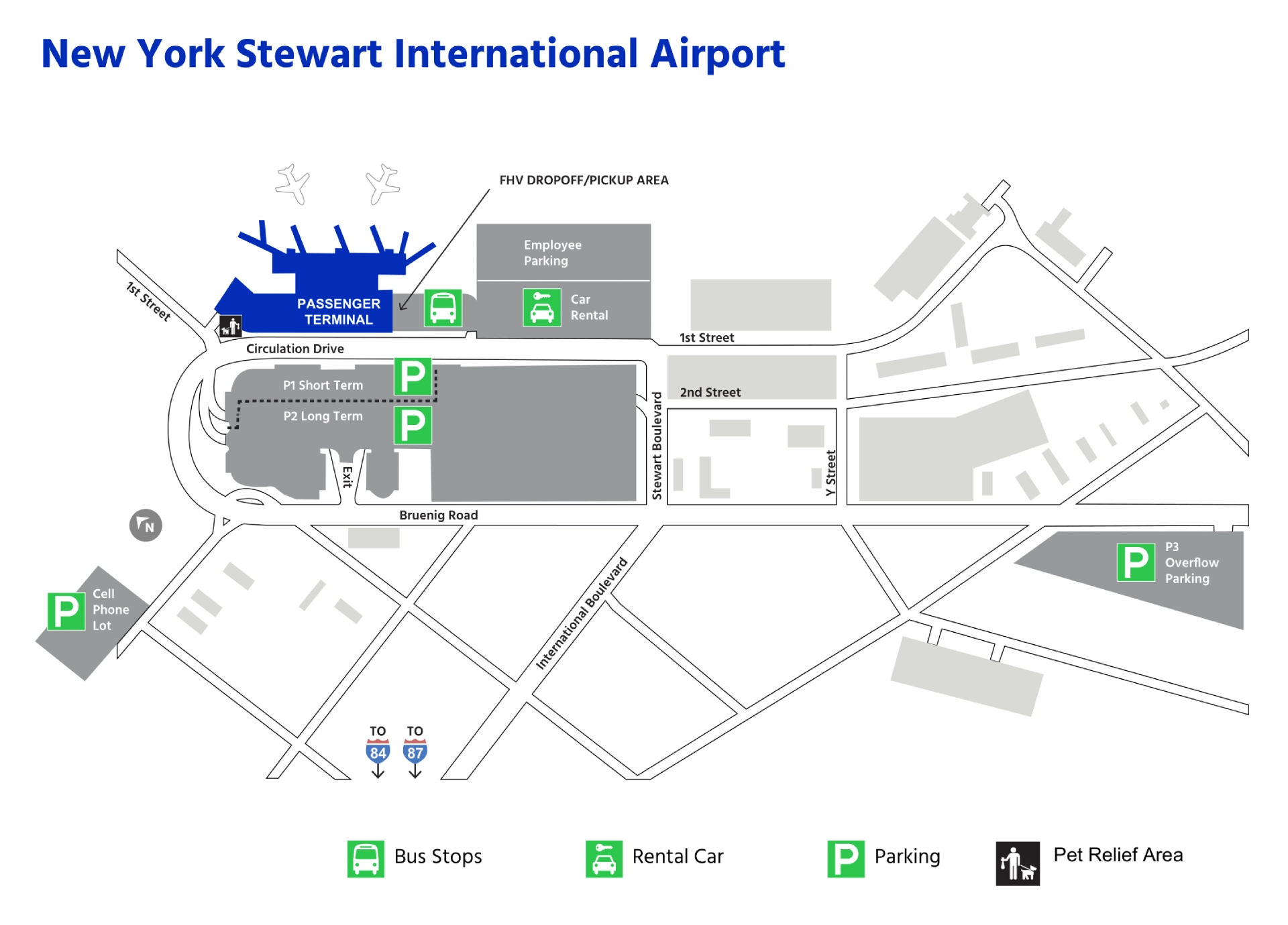
New York Stewart International Airport (SWF) has a single passenger terminal, which simplifies navigation—no trains or transfers required. That’s why travelers often appreciate its easy layout and short walks from check-in to gates.
Follow clear “Departures” and “Arrivals” signs between the lower and upper levels for smooth movement through security, gates, and baggage claim.
New York Stewart International Airport Terminal Map 2025
In 2025, PLAY Airlines announced the termination of all service from New York Stewart International Airport, with its final flight scheduled for September 1, ending the airport’s only direct international route.
Following this withdrawal, Stewart’s $20 million international terminal remains idle and unused throughout the year, leaving the facility without an active international carrier despite the prior investment in expanded capacity.
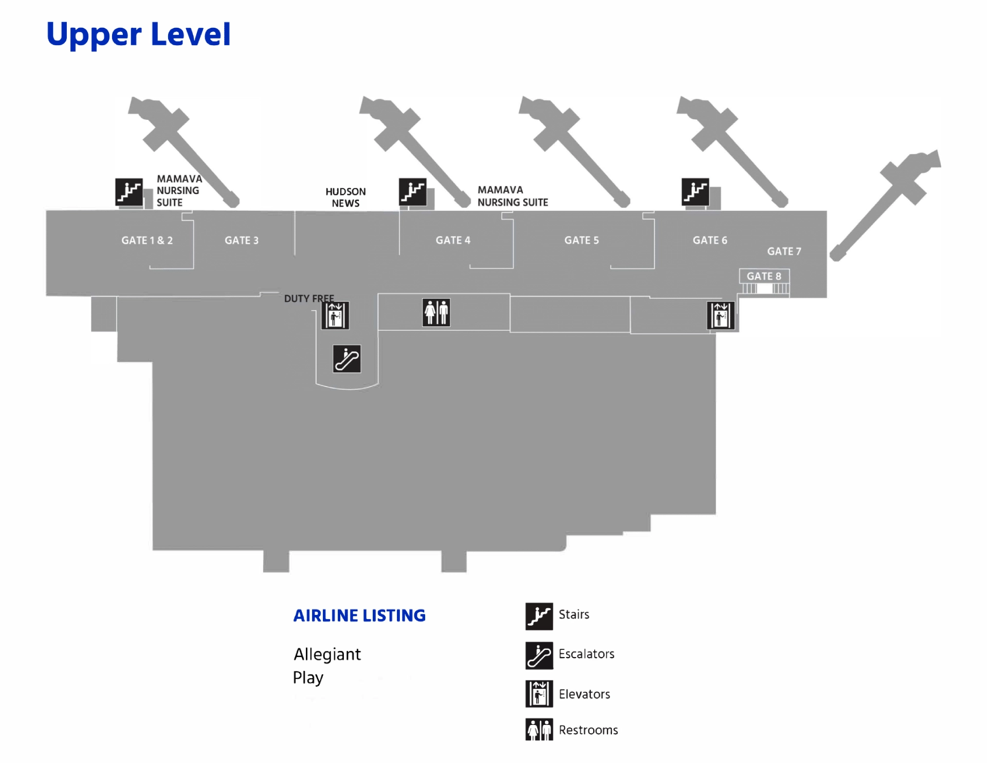
New York Stewart International Airport Terminal Upper Level Map 2025
Stewart’s Upper Level in 2025 operated with its existing international processing infrastructure, including the $37 million arrivals and customs facility first introduced in 2020 and the 19,850-square-foot FIS facility completed in 2020 and serving international passengers since 2022.
In 2025, the airport’s $20 million international terminal remained underused, with concerns raised about limited airline attraction efforts that left the terminal idle throughout the year.
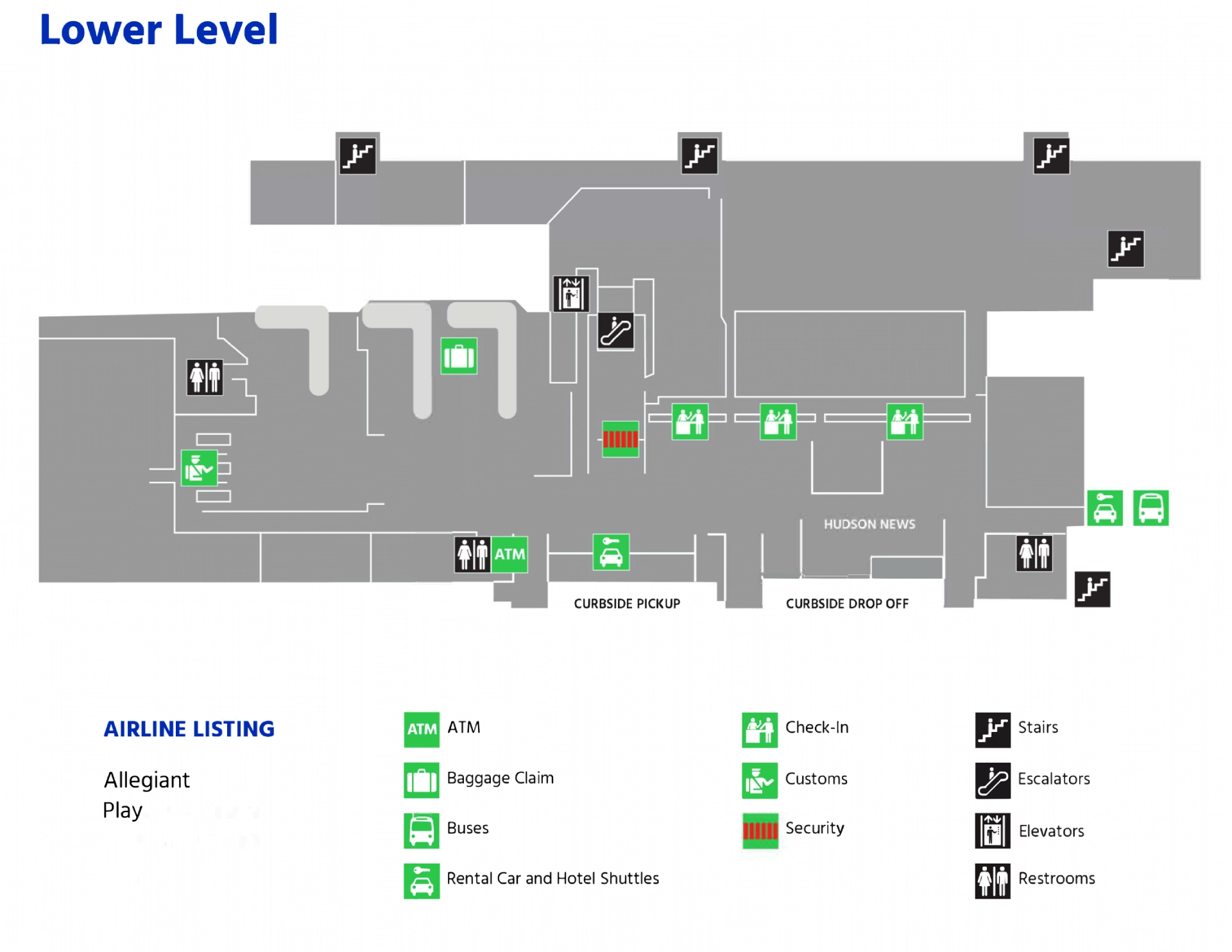
New York Stewart International Airport Terminal Lower Level Map 2025
Stewart International Airport’s lower level in 2025 reflects continued operational status with the $20 million international terminal remaining idle, as noted by the Port Authority.
The airport maintained its single modern terminal layout, providing updated passenger amenities and streamlined navigation for check-in and security.
By 2025, over $200 million in Port Authority infrastructure investments supported the airport’s international capability and overall terminal function, including the lower level.
Printable New York Stewart International Airport Terminal Map PDF 2025
FAQ
What airlines fly into Stewart Airport?
Airlines flying into Stewart Airport include Allegiant Air, Norse Atlantic Airways, and Play Airlines. Allegiant handles domestic routes from cities like Orlando and Tampa. Norse and Play provide transatlantic service from European cities such as Oslo, London, and Reykjavik.
How busy is Stewart Airport?
Stewart Airport is relatively quiet compared to major New York airports. It handles fewer than 300,000 passengers annually, serving limited domestic and transatlantic routes. Lower traffic makes it easier to navigate, with shorter security lines and faster boarding times.
How far is JFK to SWF?
The distance from JFK Airport to Stewart Airport (SWF) is approximately 85 miles (137 kilometers) by car. Driving time ranges from 1.5 to 2 hours depending on traffic. The route typically uses I-678, I-87, and I-84 through New York State.
What city is Stewart Airport in?
Stewart Airport is located in New Windsor, New York. It lies in Orange County, about 60 miles north of Manhattan. The airport serves the Hudson Valley region and is part of the Port Authority of New York and New Jersey system.