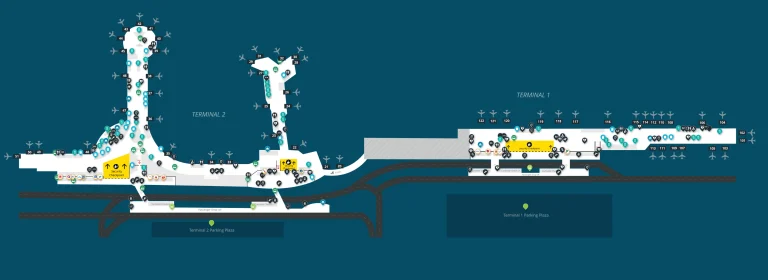
Dallas Fort Worth International Airport Terminal C Map (Most Up-To-Date)
DFW Terminal C is a long, curved concourse on the airport’s east side (the DFW horseshoe), with lower-numbered gates at the north end and higher-numbered “High C” gates stretching south. Two airside Skylink nodes split the terminal into north (around C8–C12) and south (around C27–C32) access zones, which matters when construction walls narrow sightlines. Use gate range first, then commit to a Skylink station and direction inside the Dallas–Fort Worth hub.
Map Table
| Zone | Connection | Walk Time |
|---|---|---|
| C1–C10 (North) | Skylink North (C8–C12) | 2–6 min |
| C11–C19 (Core-North) | Skylink North (C8–C12) | 1–5 min |
| C20–C39 (Core-South + High C) | Skylink South (C27–C32) | 1–10 min |
| C2 area | Skybridge link (to D near D40 → B1) | 6–8 min |
Dallas Fort Worth International Airport Terminal C Map Strategy
- Treat Skylink like a gate-range decision: C1–C19 defaults to the C8–C12 node; C20–C39 defaults to the C27–C32 node.
- Prevent the wrong-direction loop trap: for Terminal B, follow Skylink signage “to Terminal A” from Terminal C (the faster C → A → B path).
- Assume visual “false closures” near C28–C33: follow overhead Skylink signs even when walls make the concourse feel blocked.
- Build a gate-change fallback: if your gate flips between north C and High C late, re-anchor to the nearest Skylink node first, then re-route by direction—not by walking the full concourse.
2026 Dallas Fort Worth International Airport Terminal C Map + Printable PDF
In 2026, Terminal C remains in active reconfiguration: the High C rebuild (C35–C39) continues while the C28–C33 corridor is the primary disruption zone. The C30 security checkpoint stays closed, concentrating screening demand at C20. Both Skylink stations remain operational (north at C8–C12, south at C27–C32), but construction hoardings can hide escalator/elevator sightlines.

Dallas Fort Worth International Airport Terminal C Level 1 Lower Map 2025

Dallas Fort Worth International Airport Terminal C Level 2 Departure Map 2025

Dallas Fort Worth International Airport Terminal C Level 3 Mezzanine Map 2025

Dallas Fort Worth International Airport Terminal C Level 4 Skylink Map 2025

2026 Dallas Fort Worth International Airport Terminal C Map Guide
Where is the nearest Skylink station entrance (escalator/elevator landmark) for gates C1–C10?
The nearest Skylink station entrance for gates C1–C10 is the Terminal C North Skylink node, accessed by the escalators/elevators clustered between gates C8 and C12. From the C1–C10 gate range, you’re aiming for the vertical core marked by overhead “Skylink” signs near the C8-side entrance, not the south station by C27–C32.
For fastest alignment from this gate band, use these anchors:
C1–C4: follow concourse flow toward the C8 gate numbers until you hit the first Skylink escalator bank.
C5–C7: keep walking toward C8; the Skylink entrance appears before the C12 atrium zone.
C8–C10: treat C8 as the station landmark; the escalator/elevator core is effectively in your immediate gate neighborhood.
From gate C8, which Skylink direction reaches Terminal B fastest (clockwise vs counter-clockwise)?
The counter-clockwise Skylink direction from Terminal C reaches Terminal B fastest, using the train signed toward Terminal A. The clockwise option is the loop trap because it detours through Terminal E and Terminal D before reaching Terminal B.
| Skylink choice from the C8–C12 station | Train signage you follow | Terminal sequence | Why it wins/loses |
|---|---|---|---|
| Counter-clockwise | To Terminal A | C → A → B | fewer inter-terminal legs |
| Clockwise | To Terminal E | C → E → D → B | extra terminals, extra stops |
What is the exact walking distance (feet/miles) from gate C2 to gate B1 using the airside connector route?
No direct Terminal C–to–Terminal B airside bridge exists, so the C2 → B1 walk must route through Terminal D via the north connector near D40. The total airside walking distance from gate C2 to gate B1 is 1,700 feet (0.32 miles).
| Segment (airside) | Landmark-to-landmark routing | Distance |
|---|---|---|
| C2 → C–D connector | Gate C2 concourse → Skybridge entrance | 550 ft |
| Connector → Terminal D | Skybridge → emerge near Gate D40 | 650 ft |
| Terminal D → B1 | D40 corridor → curve into low B gates → B1 | 500 ft |
Which Terminal C security checkpoint is closest to gates C20–C39, and what gate-number landmark identifies it?
Checkpoint C30 is closed for construction, so the closest (and required) Terminal C security entry for gates C20–C39 is the C20 Security Checkpoint. The identifying landmark is the C20 gate-number zone itself—aim for the central C20 node rather than anything labeled “High C.”
The practical way to spot it fast is by adjacent anchors: the concourse transition around gates C19–C21 (including the Admirals Club area between C19 and C20) is the reliable “you’re here” marker. If you’re landside near the old C30/High C curb, treat that as a dead end and backtrack north until overhead signs and gate numbering bring you to C20.
What is the shortest walk (distance + turns) from the nearest Terminal C TSA exit to the nearest Skylink station?
The shortest TSA-exit-to-Skylink walk in Terminal C is from the C10 checkpoint exit to the North Skylink station at C8–C12. It is essentially a straight shot because the Skylink escalator/elevator bank sits immediately off the post-security corridor near the C8 gate-number landmark.
- Distance: ~200–300 feet total (about 1 minute at normal pace).
- Turns: 1 turn max (exit security → align to “Skylink” overhead signs → short approach to the escalators/elevators).
- Landmark triangulation: C10 exit area → gate-number progression toward C8 → first Skylink vertical core.
Where is the closest restroom to gate C17, and what is the walking distance?
The closest restroom to gate C17 is the nearby central concourse restroom block in the C15–C19 zone, reached by walking a short distance along the main corridor toward the nearest clustered gate holdrooms. The walking distance from gate C17 is about 150–250 feet (roughly 1 minute).
If restroom quality matters more than proximity, the newer High C facilities by gates C35–C39 are the upgrade choice, but they require a long southbound walk from the C17 area.
Where is the nearest water bottle filling station to gates C25–C30, and what is the walking distance?
The nearest water bottle filling station to gates C25–C30 is the refill/PourAway station at the C21 checkpoint area, just north of the C25 gate band. From the C25–C30 corridor, that checkpoint node is the most reliable “hydration anchor” before you get deeper into the construction-affected south sector.
- From C25: about 600–800 feet (3–4 minutes) to the C21 checkpoint refill station.
- From C30: about 900–1,100 feet (4–6 minutes) to the same C21 checkpoint node.
- Alternate (farther south): a water station is also present in the High C expansion area around gate C36, but that’s a longer walk than C21 for most C25–C30 positions.
Which segment of Terminal C is currently detoured by construction, and what is the signed detour route between gates C10 and C20?
The active construction detour zone in Terminal C is the south-central corridor around gates C28–C33, not the C10–C20 airside span. The signed walking path between gates C10 and C20 stays on the main concourse and remains open, so there is no special interior “detour route” required for C10 → C20 beyond following the standard overhead gate-number progression.
The detour risk that hits the C10–C20 area is landside traffic flow: curbside patterns and exits can force vehicles to re-route, which increases drop-off and pickup friction around the C20 curb face. Inside, treat C10 → C20 as a straight concourse move guided by overhead signs and increasing gate numbers.
From the main Terminal C concessions/core area, what is the nearest Skylink access point (by gate-number landmark)?
The nearest Skylink access point from Terminal C’s main concessions/core area is the North Skylink station between gates C8 and C12, using C12 as the primary gate-number landmark. The concessions hub historically clusters around the atrium/corridor near C12–C17, so the “Skylink” escalators/elevators by the C8–C12 node are the shortest, most direct vertical access.
Where is the Terminal C rideshare pickup area, and which specific exit/door leads to it from baggage claim level?
Terminal C rideshare pickup is on the Lower Level (Arrivals), centered around Doors C15–C20 on the curbside inner-lane pickup zone. From baggage claim level, the most reliable door targets are C15 or C20—follow app-based rideshare/car service signage to the curb at those door numbers rather than going upstairs to Departures.
Use door-number triangulation: baggage claim → walk toward the C15–C20 door bank → exit to the curb where pillars/signs indicate rideshare/app pickup.
Where are the Terminal Link (landside shuttle) stops for Terminal C, and which is closest to baggage claim?
Terminal Link at Terminal C is consolidated to a single landside stop on the Lower Level near Gate/Zone C17, and that same C17 stop is the closest to baggage claim. The consolidation matters because you should not expect multiple shuttle poles spread along the crescent—if you exit near C4 or the old High C curb, you’ll be walking to the C17 node.
- Stop location: Lower Level curb near C17.
- Closest baggage-claim alignment: exit doors nearest the C17 area, then follow Terminal Link signage to the single stop.
Within a 2-minute walk of gates C17–C19, where is the largest seating zone (by nearest landmark/store/gate)?
The largest seating zone within a 2-minute walk of gates C17–C19 is the combined gate holdroom seating that spans the C17–C19 gate cluster along the main concourse. The densest continuous rows sit directly in front of those adjacent gate podiums, with overflow seating extending toward the C19–C20 transition.
- C17–C18 holdrooms: longest uninterrupted rows of beam seating in this micro-zone.
- C19 holdroom edge: spillover rows that connect into the concourse widen-out approaching the C19–C20 node.
- Admirals Club entrance area (between C19 and C20): lighter-through-traffic pocket that often functions as the best “find-a-seat-fast” fallback if C17–C19 is packed.
Where is the nearest Admirals Club entrance to gate C24, and what is the walking distance?
There is no Admirals Club at or near gate C24, so the nearest Admirals Club is the Terminal C club entrance between gates C19 and C20. From gate C24, the walk is a northbound backtrack along the concourse to the C19–C20 node.
- Walking distance: about 900–1,100 feet (roughly 4–6 minutes).
- Landmark triangulation: leave C24 → follow decreasing gate numbers toward C20 → stop at the club entrance zone between C19 and C20.
What is the walking distance from gate C30 to the nearest Skylink station entrance (escalator/elevator)?
Walking from gate C30 to the nearest Skylink station entrance is under 150 feet (well under 0.03 miles), because the South Skylink node is integrated into the C27–C32 block. The correct landmark is the escalator/elevator core serving the Skylink station between gates C27 and C32.
Construction hoardings can make the area feel visually blocked, so follow overhead “Skylink” signs even if C28–C33 walls reduce sightlines—the station remains open.