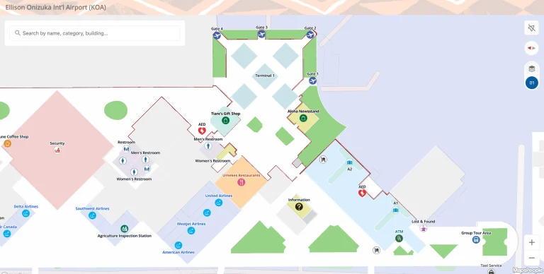
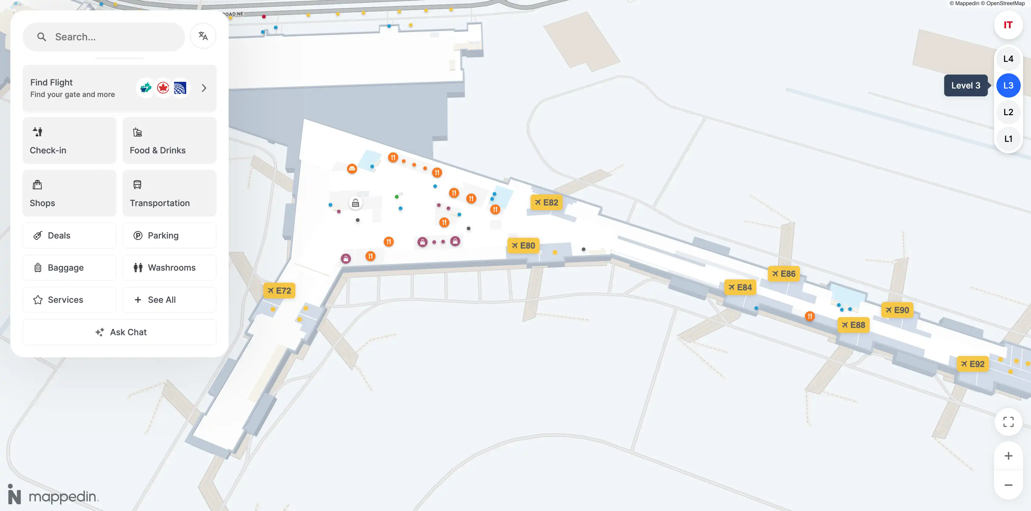
Calgary International Airport International Terminal Map (Most Up-To-Date)
YYC’s International Terminal is a long, linear extension off the main Calgary airport campus, with Concourse D (International) feeding into Concourse E (U.S. Transborder) at the far end. The layout runs on a north–south spine with big “hub” nodes (processing + concessions) and long piers beyond. The scale is the main story: the 620 m Link corridor and the E-pier length make gate access feel “farther than it looks” at Calgary’s primary air hub.
Map Table
| Zone | Connection | Walk Time |
|---|---|---|
| Concourse D (International) | Arrivals → Canada Customs → Arrivals Hall | Variable |
| Concourse E (Transborder) | CATSA (US) → US Preclearance → Duty-free funnel → E-gates | High variance |
| Link corridor | Domestic (A/B/C) ↔ International (D/E) | ~8 min / 620 m |
| Swing-gate sector (C70–C73) | Domestic ↔ International sterile routing | Variable state |
Calgary International Airport International Terminal Map Strategy
- Treat the route as checkpoint-to-checkpoint: Link corridor → CATSA (Transborder) → US Preclearance → duty-free exit → E-gates, with no improvising midstream when queues spike.
- Budget distance as a hard constraint: furthest A-gates to the E/Transborder processing entrance ~2,100 m total path; the Link corridor alone ~620 m (about 7–8 minutes at normal pace).
- Expect a forced airside-to-landside transition when bags/customs trigger it: the “you’re landside” moment is the glass exit doors out of the Canada Customs Hall into the public Arrivals Hall, followed by an up-to-Departures loop to re-enter US processing.
- Watch for access-control traps: swing-gate controlled doors near C70–C73 can silently block the “usual” corridor, and the duty-free funnel after US screening can bottleneck—use the quickest visible exit path immediately after the checkpoint instead of weaving deep into retail.
2026 Calgary International Airport International Terminal Map + Printable PDF
Operational wayfinding in 2026 still centers on two realities: long linear walks (especially Domestic A/B/C to E) and forced process transitions that break “stay airside” assumptions. The highest-risk choke points remain CATSA throughput and US preclearance metering, plus the post-checkpoint duty-free corridor that can slow late-running passengers. Plan routes around fixed checkpoints, not gate letters.
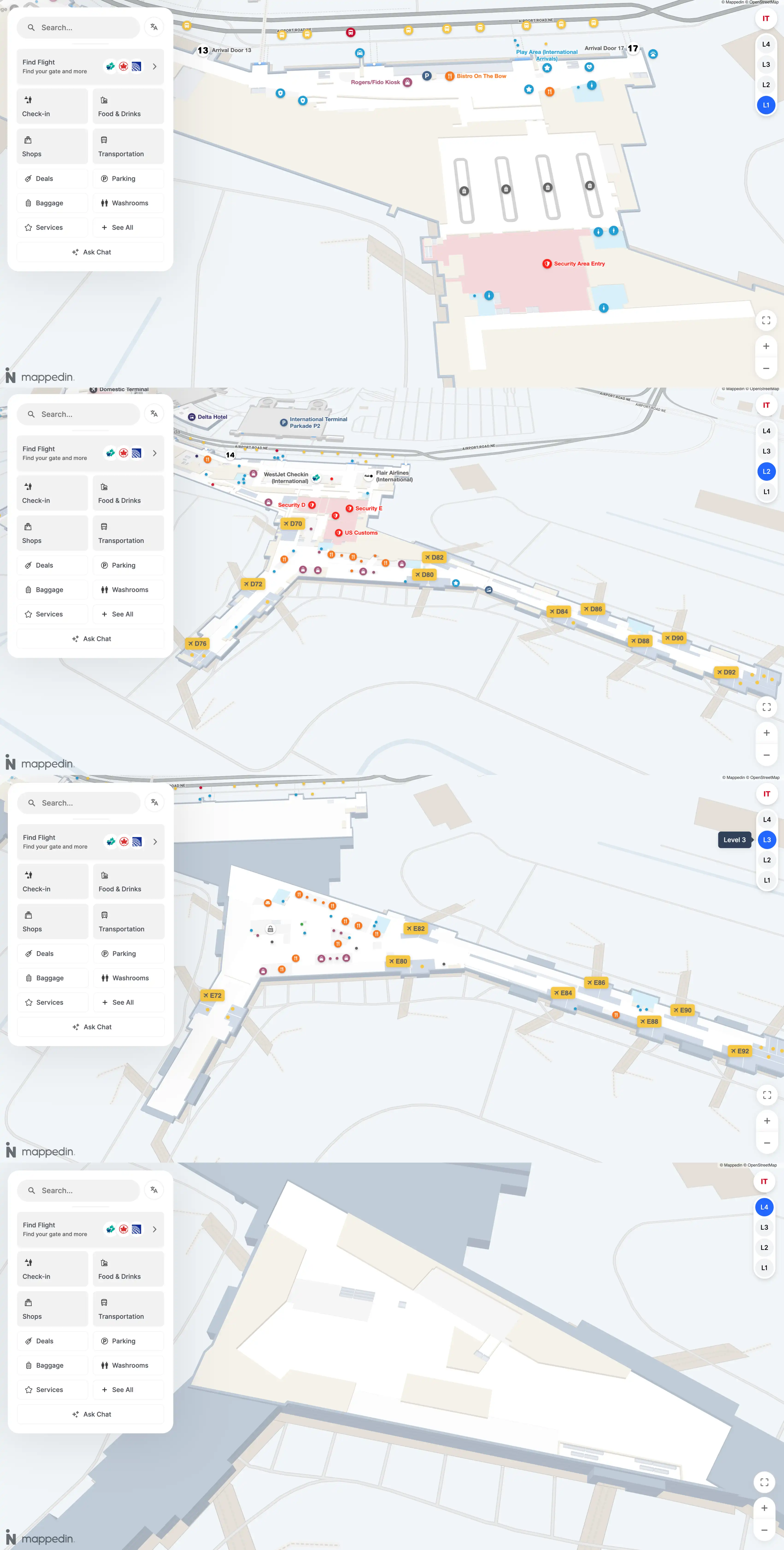
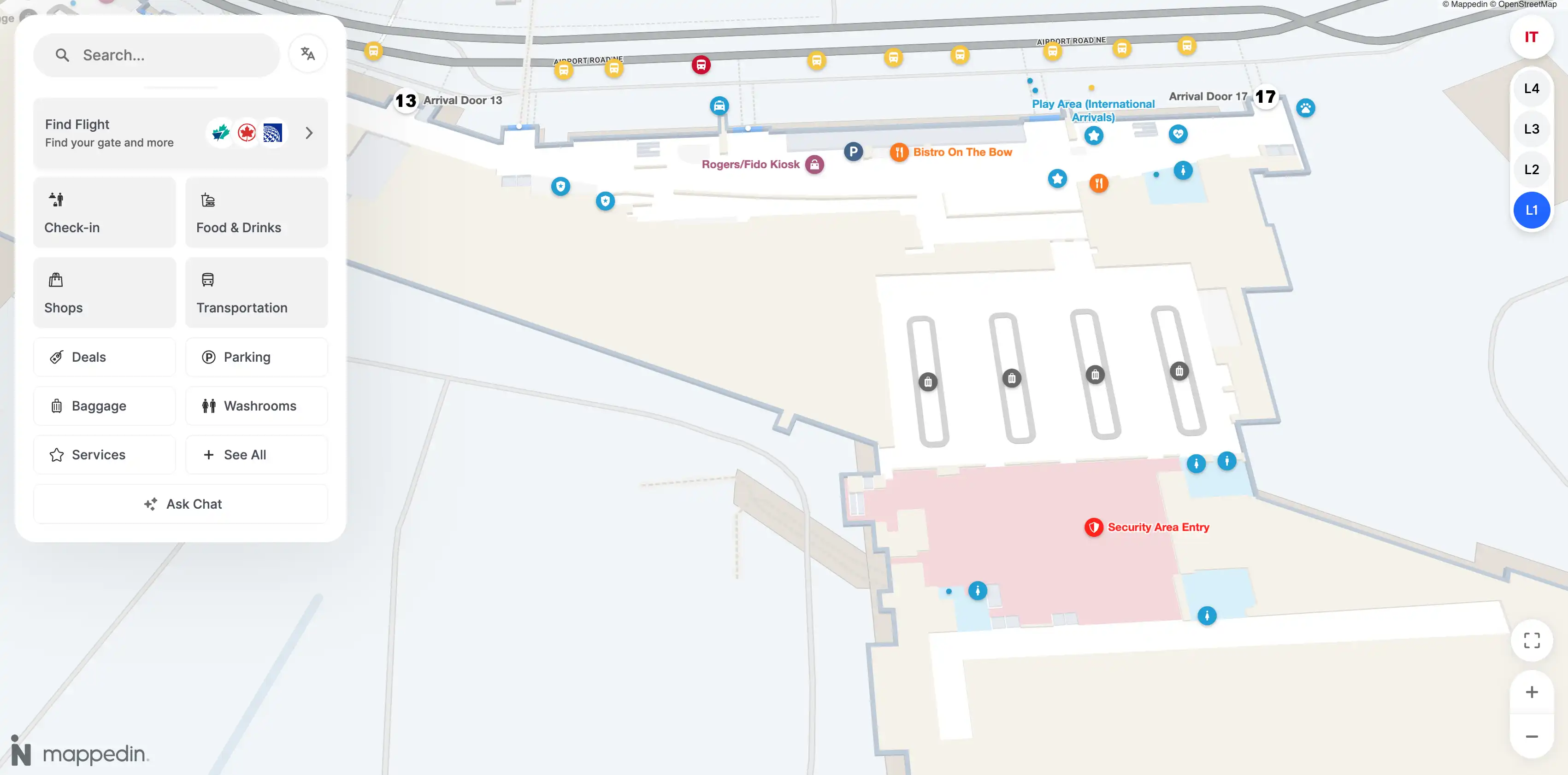
Calgary International Airport International Terminal Level 1 Map 2025
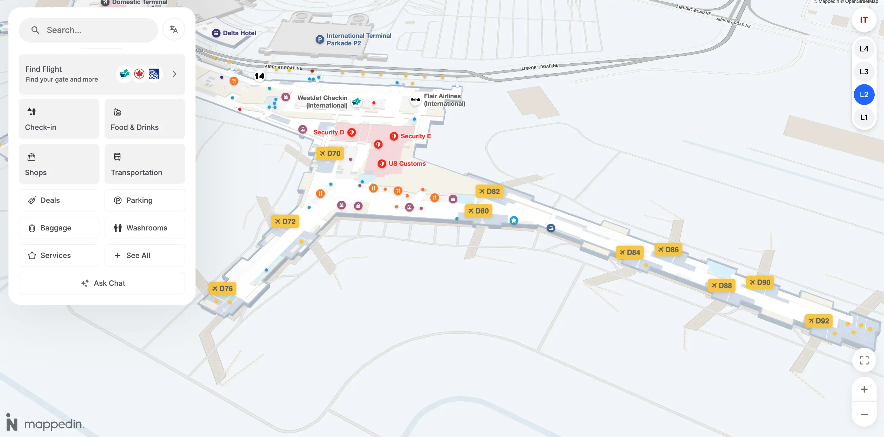
Calgary International Airport International Terminal Level 2 Map 2025
Calgary International Airport International Terminal Level 3 Map 2025
Calgary International Airport International Terminal Level 4 Map 2025
2026 Calgary International Airport International Terminal Map Guide
What is the exact walking distance (meters) from the furthest A-gates area to the E/Transborder processing entrance (the point where the route toward E-gates begins)?
Walking distance is approximately 2,100 meters from the furthest A-gates area (A1–A6 end) to the E/Transborder processing entrance where the US-bound route begins. That distance assumes a continuous walk with typical vertical transitions and the standard public/connector routing toward the International/Transborder processing core.
A practical way to “audit” the path is by segments anchored to obvious nodes: the A-gate knuckle to the Domestic hub (~600 m), across the Domestic hub toward the C-side spine (~400 m), through the Link corridor itself (620 m), then from the Link’s International Terminal end to the US processing entrance area (~400 m). The total is dominated by the Link + hub traverses, not a single straight pier walk.
Where is the exact airside-to-landside boundary (the “you’re landside” transition) when walking from D-gates toward E/US preclearance?
The airside-to-landside boundary is the glass exit doors at the end of the Canada Customs Hall, where you step out into the public Arrivals Hall. That doorway is the moment your sterile/secured path ends and you are physically back in the landside public zone.
This shows up most clearly on the “dirty” D→E connection: you follow the sterile arrivals routing from Concourse D into Canada Customs, and once you pass the customs agent area you exit through the frosted/glass doors into the Arrivals Hall. From there, the route to US preclearance requires going back up to the Departures level and re-entering the US processing system (document check/queue → CATSA (Transborder) → US CBP preclearance), rather than continuing airside straight to E-gates.
Where is the document-check position located relative to that boundary (the first staffed checkpoint you reach after the transition)?
The document-check position is immediately after the Canada Customs Hall exit doors, on the public/landside side before you can join the US processing queue. It’s the first staffed control point you encounter once you’ve crossed into the Arrivals Hall and re-orient toward the US Transborder departures route.
Practically, the sequence is: exit Canada Customs through the glass doors into the Arrivals Hall, then follow the Departures/Transborder direction back toward the US processing entrance area. Airline/connection staff and the initial document verification point sit “just beyond” that boundary so they can meter access (including the ~2-hour rule) before passengers commit into the CATSA + US preclearance lanes. This is why the landside space outside the customs exit becomes a holding/queuing zone during busy banks.
What is the fastest map-verified route from CATSA (Transborder) exit to Gate E76 (including whether using the tram is shorter than walking)?
Walking is the fastest route from the CATSA (Transborder) exit to Gate E76; taking the YYC Link tram/shuttle does not shorten this segment because the E-side station is effectively at the concourse hub you’re already entering. The time-critical variable is exiting the duty-free funnel efficiently, then using the main E-spine (and moving walkways) toward E76.
| Segment | Route (anchor points) | Typical walk time |
|---|---|---|
| CATSA exit → duty-free exit | Follow the forced duty-free path, take the most direct visible outflow toward the concourse hub | ~2–3 min |
| Concourse hub → Gate E76 | Pass the first amenity cluster (Starbucks/Vino Volo area) and continue down Concourse E; use moving walkways where available | ~3–5 min |
| Total | CATSA exit → Gate E76 | ~5–7 min |
The “make-or-break” move is right after screening: don’t get pulled deep into the retail maze—stay on the fastest through-line to the duty-free exit, then commit to the straight Concourse E spine toward the mid-70s gates.
Where is the tram station located relative to the US preclearance exit (pinpoint the closest station entrance and direction of travel)?
The closest YYC Link tram/shuttle station is immediately after the US preclearance exit, in the central Concourse E hub area just beyond the duty-free outflow. It sits at the “E-side hub” where passengers first re-enter open concourse circulation, near the first post-processing amenity cluster.
From the preclearance exit, the physical sequence is: exit screening/preclearance → move through (or immediately past) the duty-free funnel → arrive at the Concourse E hub where food/coffee is concentrated → the YYC Link station entrance is right there for travel back toward the International/Domestic side (D/C/B/A direction). In other words, the station is positioned as the E-concourse end-of-line, oriented for outbound trips away from E rather than to move you deeper toward E70–E97 gates.
Where is the pre-security waiting/queuing area that forms when US processing is restricted until “2 hours before departure”?
The pre-security waiting/queuing area forms in the public mezzanine and food court space in the International Terminal, directly outside the US processing entrance where document-check metering is enforced. That landside zone becomes the de facto holding pen because passengers are turned back before they can enter CATSA (Transborder) and US preclearance.
The crowd geometry typically concentrates along the approach path to the US processing doors and then spills into the mezzanine seating and nearby concessions, with people hovering close to the checkpoint to “time” their entry. Landmarks that define the area are the International Terminal departures hall overlook and the adjacent food outlets (the public-facing mezzanine dining area), where luggage clusters reduce usable seating and create pinch points near the entrance to the queue.
Where are the controlled “swing gate” doors that separate D-gate domestic vs US-preclearance holding (the physical access-control points)?
The controlled swing-gate doors are in the C70–C73 sector at the Concourse C/D transition, where movable glass partitions and magnetic locking doors can block the corridor and re-route passengers. These are the physical access-control points that decide whether you can continue along an “open” corridor or get forced into a sterile/customs-directed path.
You’ll recognize the location as the knuckle where Concourse C meets the International-side infrastructure: the hallway widens, and there are full-height glass barriers that can cut across the walking line. When configured for international/sterile routing, those doors close off the domestic-through movement and funnel traffic toward the arrivals/customs stream instead of letting you continue freely between concourse areas.
Where is the entrance to the duty-free corridor that passengers must pass through en route to the D/E-side, and what is the alternative bypass route (if any exists on the map)?
The duty-free corridor entrance begins immediately at the end of the US processing exit—once you clear CATSA (Transborder) and US preclearance, the path releases directly into a walk-through duty-free funnel before you reach the open Concourse E circulation. That threshold is the “no-choice” point where the retail maze starts and sightlines to gates disappear.
A bypass exists as a vertical/service alternative near the duty-free entry zone: an elevator signed for accessibility/lounges (commonly referenced near the Aspire Lounge vicinity) can lift you around the retail floor and drop you onto the concourse level, avoiding the winding aisles. The practical cue is to look for elevator/lounge-access signage right at the start of duty-free rather than committing into the curved retail path.
Which specific corridor (“High Road” vs “Low Road” style split paths shown near podium access) connects the boarding pass scan point to the jetbridge corridor for the mixed-use gates in the C70–C73 / D–E overlap zone?
The sterile ramp-style corridor (the longer, tunnel-like routing) is the path that connects the boarding pass scan point to the jetbridge in the mixed-use C70–C73 overlap zone, because it preserves separation from the glass-walled arrivals stream when the swing configuration is active. That’s the operational “default” connection when the gates are being used in mixed or international modes.
In practice, the split is controlled by the swing-gate doors and partitions near the podium: one side aligns with the public-facing concourse circulation, and the other aligns with the segregated sterile corridor that bends away from the main flow. When the partitions are set to protect sterile separation, follow the corridor that drops you into the enclosed ramp/sterile walkway toward the jetbridge rather than the more open concourse-adjacent line—this is the route designed to avoid crossflow with arriving passengers.
What is the exact walking distance from US preclearance exit to the nearest restrooms (shortest path, meters)?
Walking distance is approximately 20–30 meters from the US preclearance exit to the nearest restrooms. The nearest washrooms are positioned almost immediately as you re-enter the Concourse E hub circulation right after the security/preclearance release point.
Expect the shortest path to be a straight-line move from the exit threshold into the first open hub area, with the restrooms typically on the same side of the hub as the first amenity cluster. If you find yourself deep inside the duty-free aisles, you’ve overshot the fastest line—backtrack toward the first concourse hub opening where the restroom signs appear within a few dozen meters.
What is the exact walking distance from US preclearance exit to the nearest food/coffee option inside the secured E-gates area?
Walking distance is approximately 15–20 meters from the US preclearance exit to the nearest food/coffee option in the secured E-gates area. The first options sit right at the Concourse E hub immediately after you emerge from the duty-free release into open circulation.
The shortest path is to move straight out of the post-processing funnel into the first hub node, where the initial concession cluster begins (the same “entry node” that anchors most wayfinding for E-gates). If you’re forced into the curving duty-free path, the distance becomes functionally longer due to weaving—so the time-saving move is to take the most direct through-line to the duty-free exit and then turn into the nearest visible coffee counter at the hub.
What is the shortest map-verified route from International check-in/bag drop area to the Transborder CATSA entrance (identify turns/landmarks shown on the terminal map)?
The shortest route is a straight landside walk along the International Terminal Departures level from the International check-in/bag drop hall to the US Transborder departures hall, then into the Transborder CATSA/US processing entrance at the back of that hall. This path avoids any airside detours and keeps you on the public departures spine until the checkpoint.
From International check-in, orient yourself toward the long windowed curbside façade and follow the Departures-level flow toward the Transborder end of the building. Stay on the main landside connector corridor (the same spine that links D-side and E-side check-in zones), passing the open departures hall space until you reach the US Transborder check-in/departures area. The CATSA (Transborder) entrance sits set back behind the check-in zone as the “entry throat” into the US processing queue.