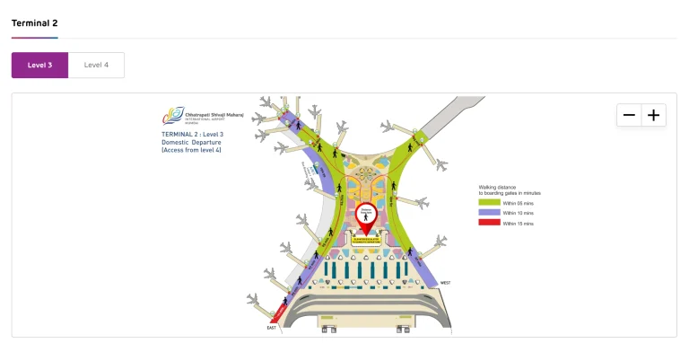
Bergen Airport Map (Most Up-To-Date)
Bergen Airport, Flesland is a single-terminal, “wings spread wide” layout: Arrivals and ground transport sit on Level 0, while Departures, check-in, and security are one level up. Airside, the domestic wing is closest to the core, then the Schengen D-pier, with the non-Schengen E-gates at the far tip. Within Bergen’s main aviation hub, the longest walks run linearly along the international pier, with passport control acting as the hard boundary.
Map Table
| Terminal | Key Airlines | Primary Function | Transfer Mode |
|---|---|---|---|
| Single terminal (T3 + legacy wing) | SAS, Norwegian, Widerøe | Domestic + Schengen + non-Schengen | Walk-only corridors, escalators/elevators (L0↔L1), Bybanen (lower level) |
Bergen Airport, Flesland Map Strategy
- Treat transport start times as a chokepoint: know the exact Arrivals exit doors to Flybussen bays and the fully indoor path down to Bybanen before you land.
- Neutralize bag-drop cutoffs by planning for the vertical chokepoint (curb on Level 0 → check-in on Level 1) and walking straight to kiosks/counters.
- Assume security can spike: locate where the physical queue tail forms in the departures hall and the Fast Track entry position before you join any line.
- For non-Schengen flights, budget the long pier walk plus passport-control variability; enter the international flow early enough that duty-free + border control can’t become the single point of failure.
2026 Bergen Airport Map + Printable PDF
The current Bergen Airport, Flesland terminal remains a single connected building with Level 0 handling arrivals/curb access and Level 1 handling departures, bag drop, and the main security checkpoint. The key 2026 navigation truth is unchanged: non-Schengen departures require a long pier walk past the Schengen gates to reach passport control, then the E-gate zone (23–27). Ground transport still funnels through one central vertical core.
2026 Bergen Airport Map Guide
What is the exact walking route (and distance) from the Long Term/Hourly Garage pedestrian exit to the main check-in doors, including whether the path is fully covered?
The walk is 150 feet from the Long Term/Hourly Garage pedestrian exit to the terminal’s main entrance doors, and the crossing is covered. Exit the garage at the elevator/stair core facing the terminal, follow the marked pedestrian path to the crosswalk over the terminal roadway, then continue under the terminal canopy to the Level 2 ticketing/check-in doors. The cover spans the roadway gap and continues into the curbside canopy, so you stay protected from rain from the garage-side exit to the terminal entry zone.
Where is the overflow lot shuttle pickup point relative to the terminal (which curb/door), and what is the walking distance from that pickup point to airline check-in?
The overflow shuttle drops passengers at the Level 2 Departures/Ticketing curb near the center of the terminal frontage, then it’s a short curb-to-doors walk into check-in. Use the overflow lot’s marked bus shelter/central pickup point in Lots C/D, ride to the upper-level curb drop, and enter through the nearest “Ticketing/Departures” doors into the Level 2 ticketing hall (Savannah Square area).
| Segment | Where you go | Distance |
|---|---|---|
| Shuttle drop-off → check-in doors | Level 2 departures curb → nearest ticketing doors | short curb walk |
| Lot C/D → terminal (if walking instead) | Overflow lots → terminal frontage | ~878 ft |
Where is Delta Air Lines bag drop physically located inside the terminal, and what is the shortest path from bag drop → TSA checkpoint entrance?
Delta’s bag drop sits at the south end of the Level 2 ticketing hall. Walk straight from the Delta counter toward the nearby South security checkpoint entrance—it’s essentially adjacent, with less than 100 feet of walking.
From the main Level 2 doors, orient to Savannah Square (the central atrium) and continue toward the Delta-branded counter zone at the south end. After you finish at bag drop, turn toward the security lanes positioned near that same south-end cluster and follow the TSA queue stanchions into the South checkpoint entrance rather than walking the hall toward the north checkpoint.
What is the exact walking distance from the TSA checkpoint exit to the farthest gate in the concourse (gate-to-gate worst case)?
The maximum walk from the TSA checkpoint exit to the farthest gate is about 820 feet. That worst case typically means clearing security, then continuing down the single linear concourse toward the far end gates (often referenced as the G15/G20 end, depending on numbering in use).
| Start | End | Distance |
|---|---|---|
| TSA exit (either checkpoint) | Farthest gate at the end of the concourse | ~820 ft |
Where is the TSA PreCheck lane entrance positioned relative to the main security queue (left/right split), and what is the shortest approach path from check-in?
The TSA PreCheck entrance is positioned to the left of the main security queue. Approach the checkpoint from the Level 2 ticketing hall and aim for the left-side lane cluster where the premium/crew-side lanes sit, using the CLEAR enrollment kiosk at the screening entrance as your visual confirmation you’re in the right zone.
From check-in, walk toward the nearest security checkpoint (South by Delta, North by United/American), then stay on the left edge of the queue area as the stanchions begin. If the first line you reach doesn’t clearly show PreCheck signage, keep moving along the front of the checkpoint entrance until you see the dedicated PreCheck markers rather than committing to the center regular line.
Which exact baggage claim carousel(s) serve American Airlines vs Delta Air Lines at SAV, based on the terminal’s baggage claim layout?
Carousel assignments are dynamic, so you must confirm on the flight display screens when you enter the Level 1 baggage claim hall. SAV typically runs two primary belts (Carousel 1 and Carousel 2), and the airline-to-belt pattern can flip based on arrival banks and staffing.
- Delta Air Lines: typically Carousel 1 (often treated as the primary belt, aligned with the south-side flow from above).
- American Airlines: typically Carousel 2 (the other main domestic belt).
- Verification point: the baggage claim entry from the central escalators/elevators, where the first flight-information monitors face the belts.
What is the shortest indoor route from the last arriving gate to the baggage claim hall, and where are the first visible baggage belts from the entry point?
The fastest indoor route is the straight-line concourse walk back to the central terminal atrium, then down to Level 1 via the main escalators/elevators. Walk from the arriving gate along the single concourse toward Savannah Square, pass the security exit area, then take the central vertical core down to the baggage claim hall.
The first visible belts appear immediately as you enter the Level 1 claim space from that central escalator/elevator entry point, with the flight-information monitors positioned to direct you to Carousel 1 or Carousel 2 before you commit to a belt-side walkway.
Where are the rental car counters located relative to baggage claim (same level / which corridor), and what is the exact walking distance from baggage claim → rental counters?
The rental car counters are on the same level as baggage claim (Level 1) inside the baggage claim hall, and the walk is under 100 feet. From the carousels, head to the counter wall directly opposite/adjacent to the belts—look for the line of brand signs (Alamo, Avis, Budget, Dollar, Enterprise, Hertz, National, Payless, Thrifty).
You don’t need a separate corridor: the counters are part of the claim hall footprint, so the shortest path is simply belt area → across the open hall → counter queue frontage.
Where is the rental car return entrance (the point where “Car Rental Return” signage first becomes actionable), and what is the exact walking route from return drop-off → departures/check-in?
The rental car return becomes actionable on Terminal Drive when you’re on the one-way terminal loop and can physically peel into the rental return lanes feeding the adjacent garage/return area. Follow “Rental Car Return” signs on the approach to the terminal frontage, then turn into the designated return entrance that routes you into the return bays within/along the parking structure next to the terminal.
After drop-off, walk via the covered pedestrian walkway back into the terminal on Level 1, then go up to Level 2 for departures. Enter the building through the Level 1 doors near the rental-car pedestrian access, take the nearest elevator/escalator to Level 2, and you’ll emerge into the ticketing/check-in hall (Savannah Square spine) without needing to cross traffic at the upper curb.
What food/coffee venues are located post-security, and which one is closest (by walking distance) to the earliest-morning departure gates?
Starbucks post-security (between Gates 9–11) is the most reliable early option and is closest to the central gate cluster that feeds the first wave of morning departures. Other post-security venues are distributed along the same single concourse, so distance differences are small, but the Gates 9–11 zone sits near the concourse middle where you can pivot quickly to either direction.
- Starbucks (between Gates 9–11; earliest reliable coffee)
- PGA Tour Grill (between Gates 9–11)
- Leopold’s Ice Cream (between Gates 9–11)
- The Stella Bar (between Gates 7–8)
- Burger King (between Gates 3–5)
- Great American Bagel (between Gates 3–5)
- Passport Club lounge (near Gates 10–12)
Where is the designated rideshare pickup zone (exact curb/door), and what is the walking distance from baggage claim exit → rideshare pickup?
Uber/Lyft pickup is at the North Entrance on the Level 1 arrivals/baggage claim curb, and the walk is under 200 feet from the baggage claim exit doors. From the baggage claim hall, head toward the north end of the building, exit through the North Doors, and step directly onto the marked rideshare pickup curb zone.
From the central escalators/elevators down from the concourse, orient yourself in the baggage claim hall and move right (north) toward the end doors rather than exiting at the center curb. The pickup area sits just outside those north-end doors, away from the most congested center frontage, so you should see rideshare signage immediately once you clear the doorway.