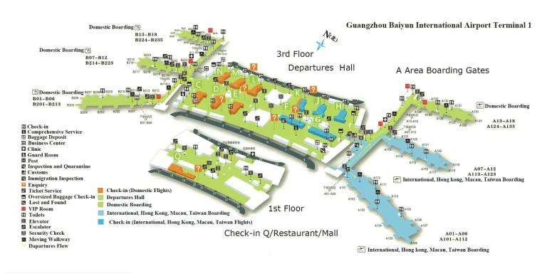
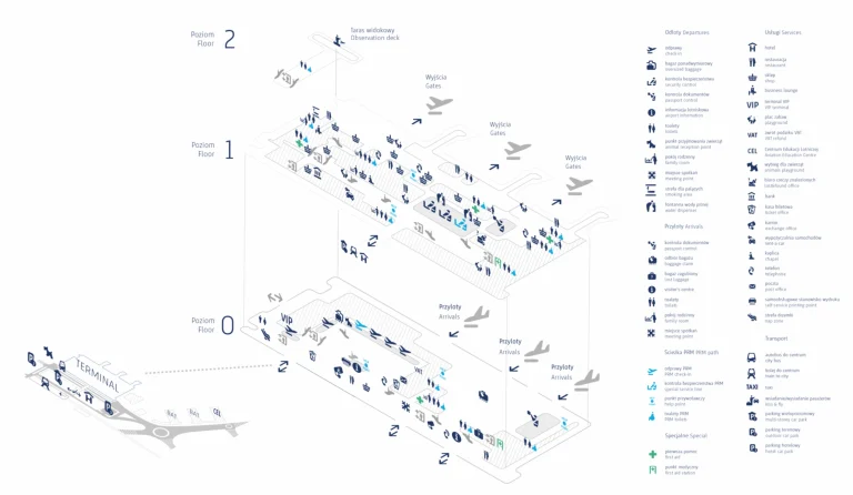
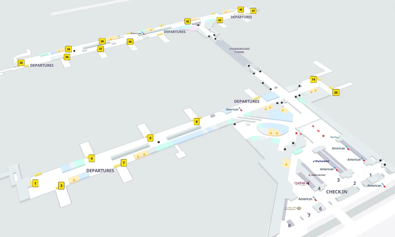
John F Kennedy International Airport Map (Most Up-To-Date)
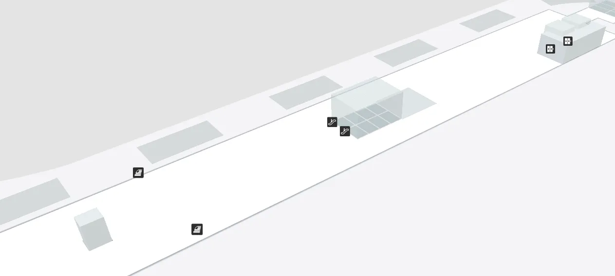
JFK is a ring-road airport: terminals sit like separate islands around a central loop, with the AirTrain tracing the perimeter rather than cutting straight across. The scale is big enough that “I can see it” rarely means “I can walk to it,” especially during construction detours. Within New York City’s main airport complex, most transfers are landside choices (curb vs AirTrain vs shuttle) where one wrong branch can add 20+ minutes.
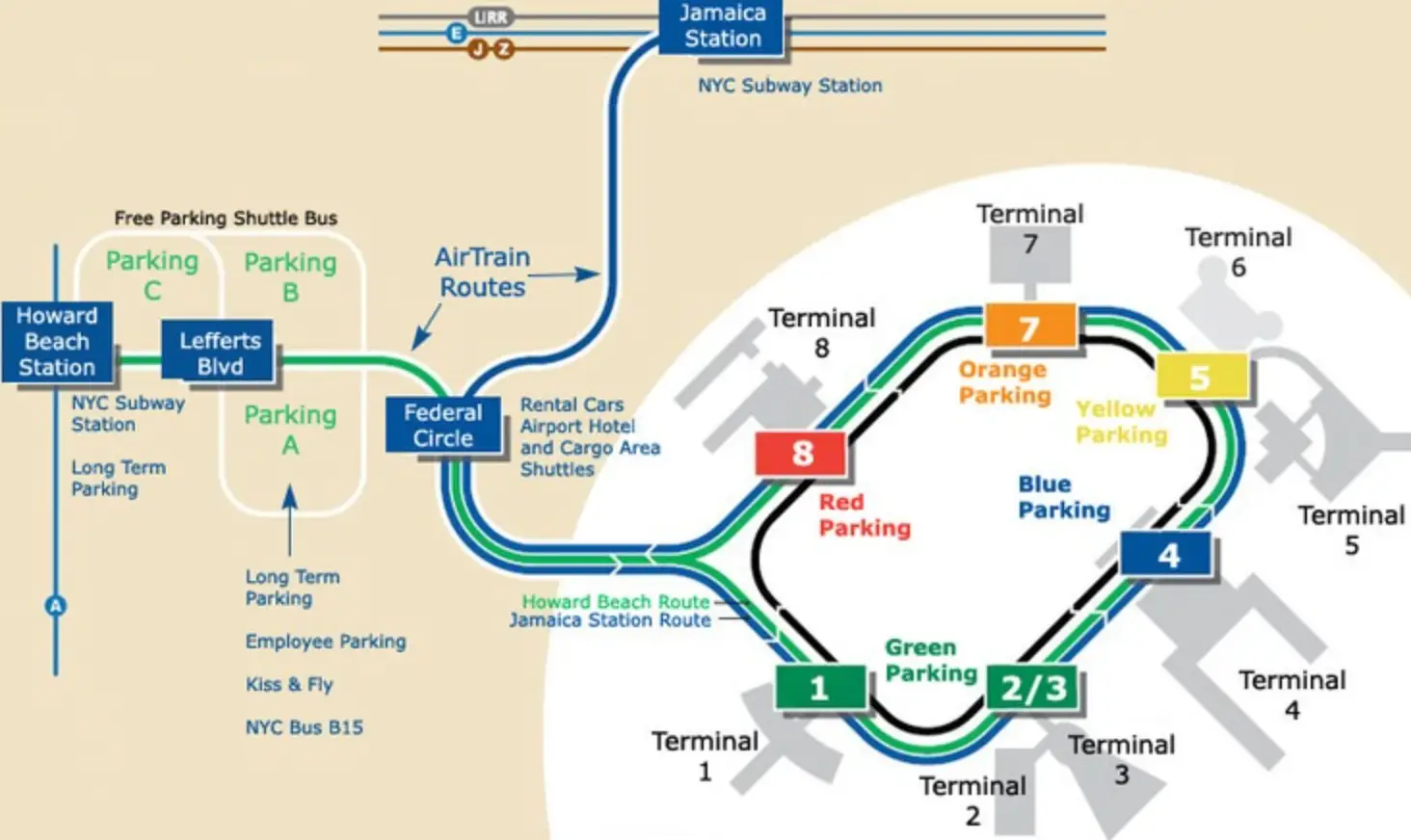
Map Key
| Terminal | Key Airlines | Primary Function | Transfer Mode |
|---|---|---|---|
| Terminal 1 | International carriers | International departures/arrivals | AirTrain, curb pickup |
| Terminal 4 | Delta, partners | Major international + domestic hub | AirTrain (Level 3), Lot 66 ride-app shuttle, taxi stand |
| Terminal 5 | JetBlue | Domestic focus, some international | AirTrain via Skywalk, Howard Beach ride-app routing |
| Terminal 7 | Limited carriers | Regional/international mix | AirTrain, walk-to-T8 option |
| Terminal 8 | American, partners | Major domestic + international | AirTrain, walk-to-T7 option |
John F. Kennedy International Airport Map Strategy
- Assume re-screening unless you’re clearly staying airside: many terminal-to-terminal moves require exit → AirTrain/shuttle → TSA again, and Terminal 4’s alternate downstairs security is a separate entrance choice, not a shortcut you’ll stumble into.
- Treat JFK as landside chess: decide first (curb pickup vs AirTrain vs shuttle) before you follow crowds, because construction reroutes make “wrong-way” corrections expensive.
- Lock rideshare decision points in your head: Terminal 4 restricted hours push ride apps to the Lot 66 shuttle; Terminal 5 ride apps push you onto AirTrain toward Howard Beach—no “simple curb pickup” fallback.
- Use AirTrain like a loop map, not a train map: wrong loop direction or wrong branch turns Terminal 8 → Terminal 4 into the long way around; terminal order awareness matters more than platform proximity.
John F Kennedy International Airport Terminal Map 2025-2024
In 2026, JFK’s active redevelopment keeps the airport “connected-looking” but decision-driven: Terminal 4 rideshare access flips by time window (curb vs Lot 66 shuttle), Terminal 5 rideshare is functionally pushed to Howard Beach, and AirTrain routing choices (loop direction/line) determine whether a terminal hop stays short or becomes an orbit.

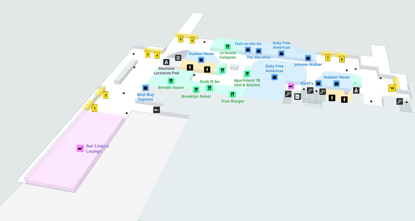
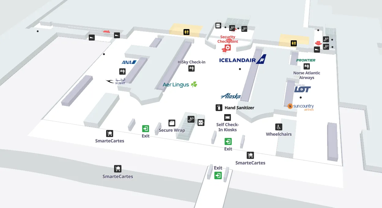
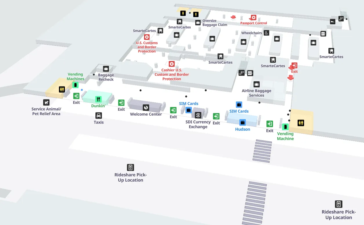
John F Kennedy International Airport Terminal 1 Map 2025-2024
On May 2, 2024, Unibail-Rodamco-Westfield Airports and The New Terminal One initiated the Competitive Evaluation Process for the food hall and travel essentials tenders at John F. Kennedy International Airport Terminal 1.
This action formally began the selection process for vendors that will operate the upcoming food court and essentials outlets, representing a defined step in the commercial development program for the privately funded all-international terminal and establishing the foundation for future passenger dining and retail services.
John F Kennedy International Airport Terminal 1 Departures Map 2025-2024
John F Kennedy International Airport Terminal 1 Arrivals Map 2025-2024
In February 2024, John F. Kennedy International Airport Terminal 1 closed for several days following a power outage and electrical fire. The outage, which began earlier in the week, forced airlines to divert and cancel flights.
Terminal 1 remained shut down during this period due to the electrical issues before normal scheduled flight operations resumed on February 17, 2024, marking a temporary disruption that directly impacted arrivals and overall terminal accessibility.
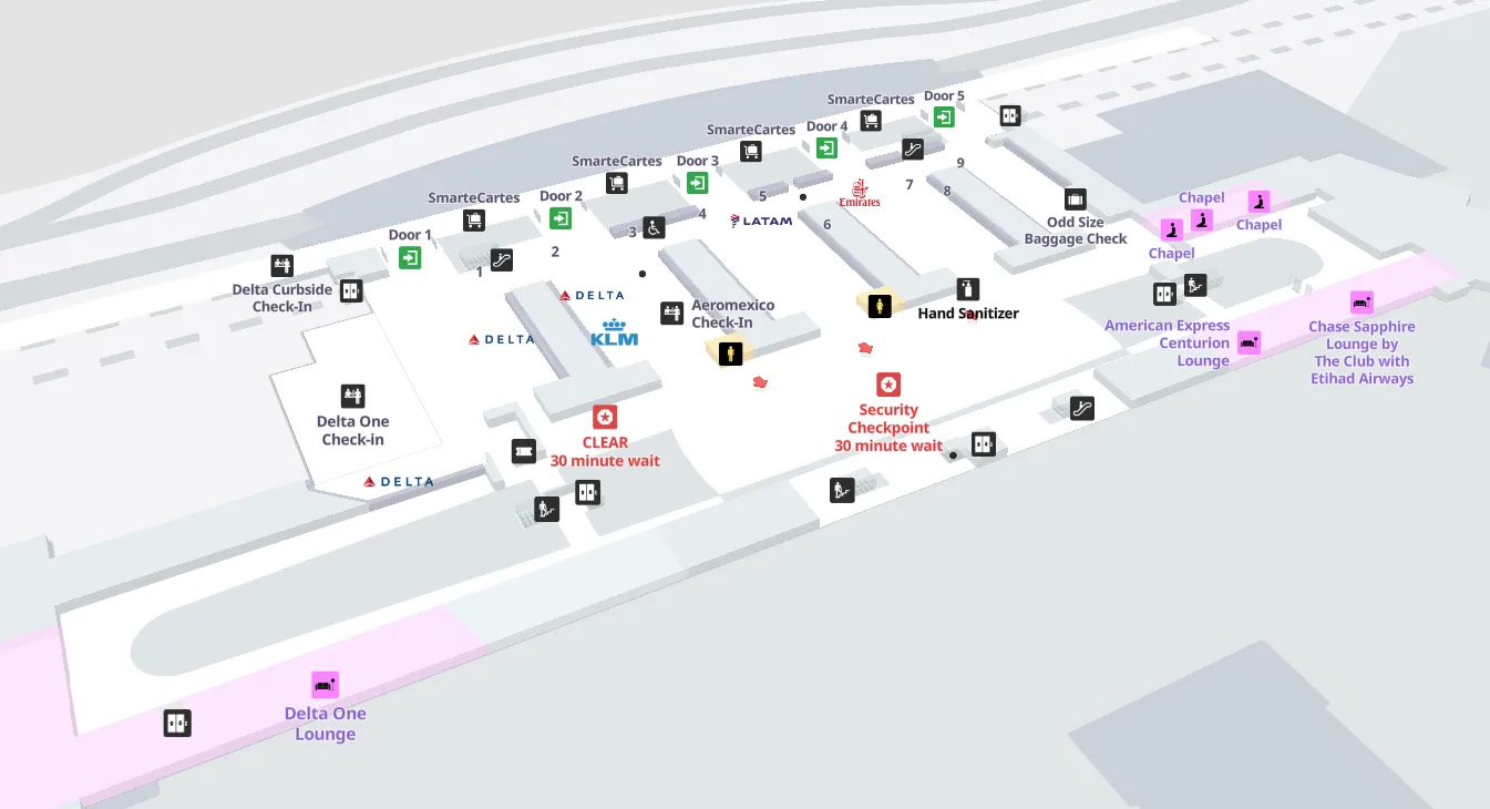
John F Kennedy International Airport Terminal 4 Map 2025-2024
In 2024, John F. Kennedy International Airport Terminal 4 began major renovations to its departure halls as part of a $3.8 billion expansion project. The upgrades included modernization of ticketing areas and security checkpoints, along with planned improvements to the overall arrivals and departure halls.
The project also encompassed concourse expansion with 16 new domestic gates and enhancements to the surrounding road network, marking a significant step in reshaping the terminal’s check-in and departure operations.
John F Kennedy International Airport Terminal 4 Arrivals Map 2025-2024
In 2024, John F. Kennedy International Airport Terminal 4 completed a $1.5 billion expansion that added ten new aircraft parking positions, an additional domestic baggage claim carousel, and consolidated all Delta operations into the terminal.
Earlier in the year, an Enhanced Passenger Process using facial recognition was introduced in collaboration with U.S. Customs and Border Protection.
Additionally, ride-share and for-hire vehicle pickups for arriving passengers were relocated to the remote Lefferts Boulevard lot, accessible by frequent shuttle buses.
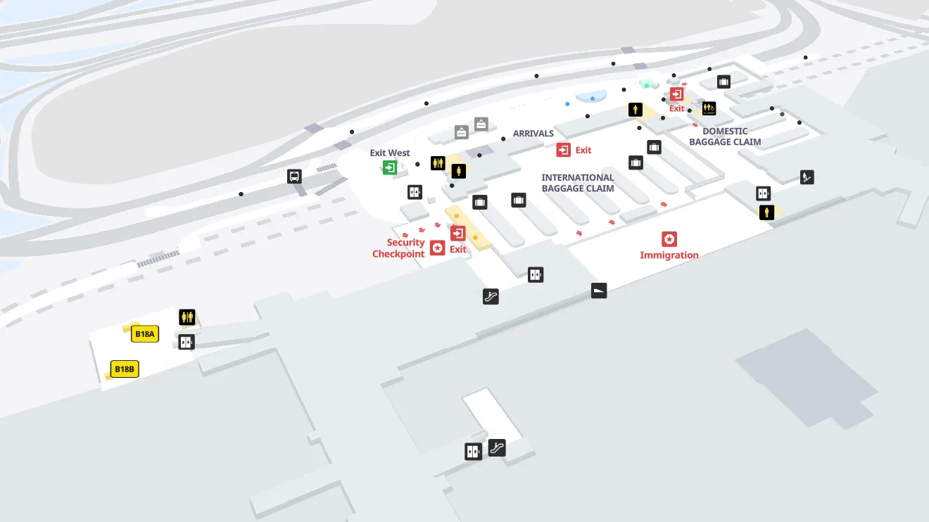
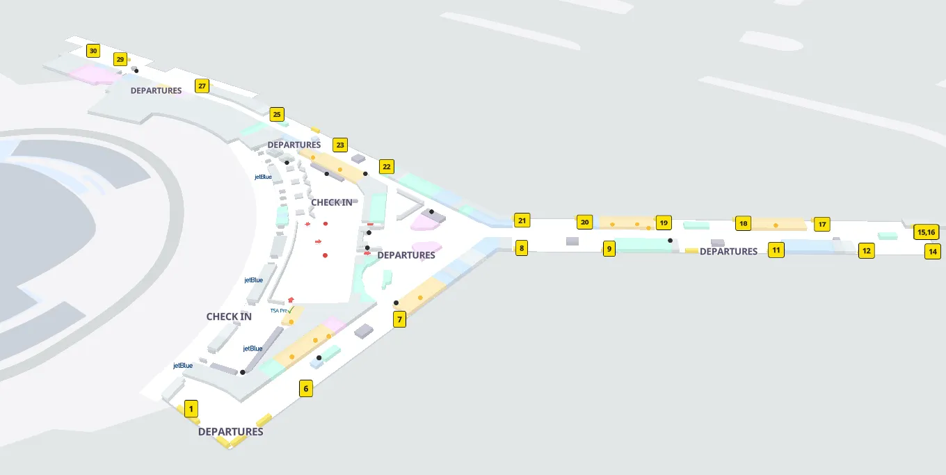
John F Kennedy International Airport Terminal 5 Departures Map 2025-2024
John F Kennedy International Airport Terminal 5 Arrival Gates Map 2025-2024

John F Kennedy International Airport Terminal 5 Arrivals Map 2025-2024
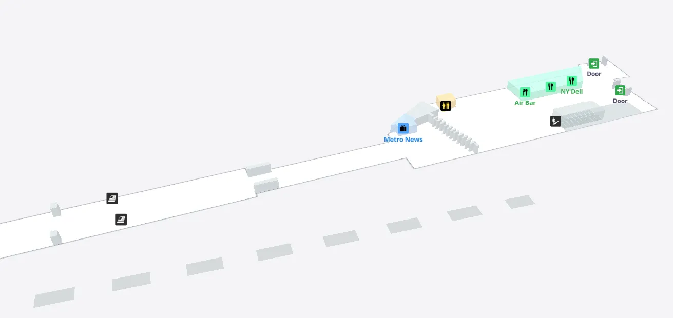
John F Kennedy International Airport Terminal 7 Lounges Map 2025-2024

John F Kennedy International Airport Terminal 7 Departures Map 2025-2024
John F Kennedy International Airport Terminal 7 Ticketing Map 2025-2024
John F Kennedy International Airport Terminal 7 Arrivals Map 2025-2024
John F Kennedy International Airport Terminal 8 Lounges Map 2025-2024
In December 2024, John F. Kennedy International Airport Terminal 8 expanded its lounge offerings with the official opening of a new Gameway gaming lounge. The facility introduced dedicated spaces for travelers to access gaming stations and entertainment services within the terminal.
This marked the addition of a specialized leisure-focused lounge option at Terminal 8, enhancing the range of amenities available to departing and connecting passengers through a newly established Gameway location.
John F Kennedy International Airport Terminal 8 Departures Map 2025-2024
In 2024, John F. Kennedy International Airport Terminal 8 departures and check-in areas entered a multi-year redevelopment led by T8 Innovation Partners in collaboration with American Airlines and the Port Authority of New York and New Jersey.
The project focused on reimagining the customer experience through extensive commercial upgrades. Plans included the introduction of more than sixty new shops and restaurants designed to expand retail and dining options throughout the terminal’s departures and check-in spaces.
John F Kennedy International Airport Terminal 8 Arrivals Map 2025-2024
John F Kennedy International Airport Federal Circle Station Level 3 Map 2025-2024
John F Kennedy International Airport Federal Circle Station Level 2 Map 2025-2024
John F Kennedy International Airport Federal Circle Station Level 1 Map 2025-2024

John F Kennedy International Airport Observation Deck Map 2025-2024
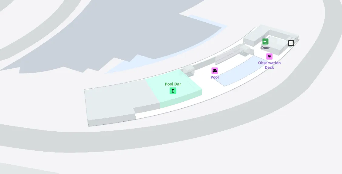
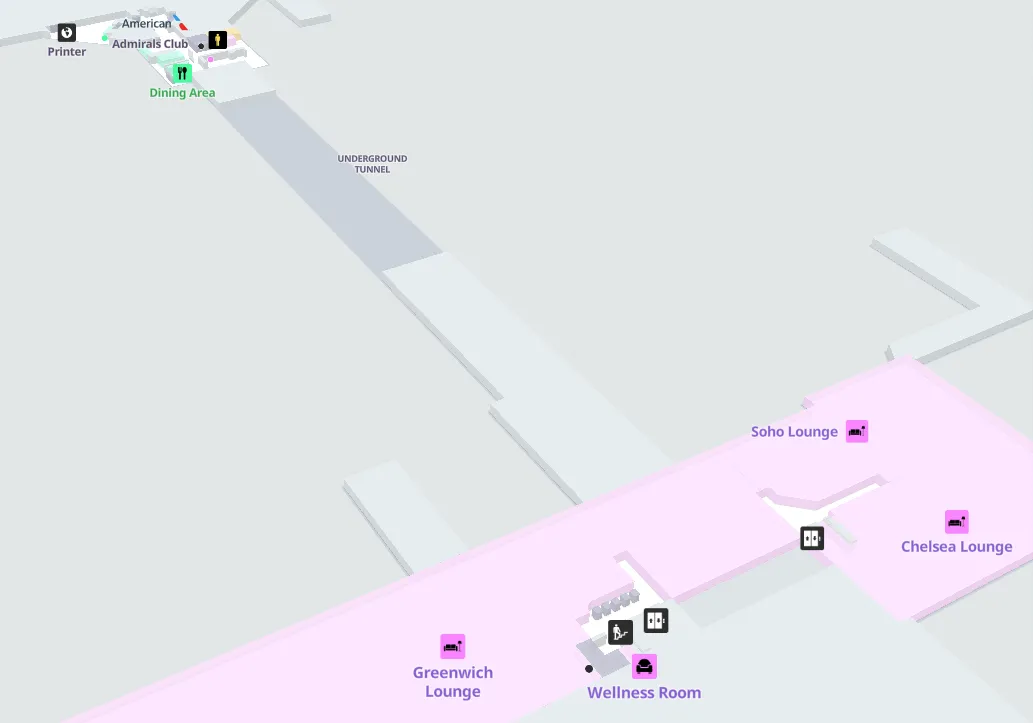
John F Kennedy International Airport Lisbon Lounge Map 2025-2024
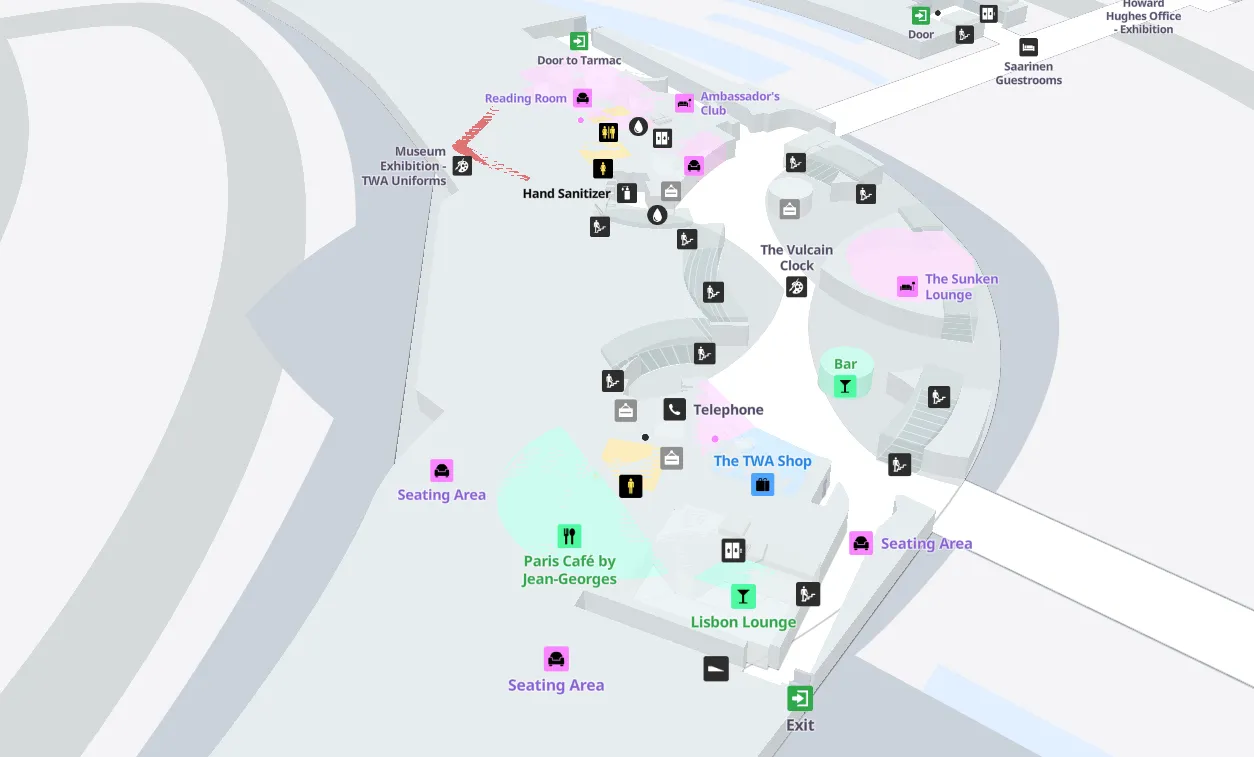
John F Kennedy International Airport TWA Hotel Map 2025-2024
John F Kennedy International Airport Jamaica Station Map 2025-2024
From July 1 through Labor Day 2024, the AirTrain JFK single-ride fare at Jamaica Station was reduced to $4.25. The temporary fare adjustment was implemented to encourage travelers to use subway and Long Island Rail Road connections from New York City, the Hudson Valley, and Long Island for airport access.
This seasonal change directly impacted the Jamaica AirTrain platform by lowering the cost of passenger travel during the peak summer period.
John F Kennedy International Airport Howard Beach Station Platform Map 2025-2024
From July 1 through Labor Day 2024, the AirTrain JFK fare at Howard Beach Station was reduced to $4.25. The temporary 50 percent reduction applied to single-ride tickets at the Howard Beach AirTrain platform, aligning with the same fare change implemented at Jamaica Station.
This adjustment lowered passenger travel costs during the peak summer season, directly affecting airport access through the Howard Beach connection.
John F Kennedy International Airport Howard Beach Station Lower Level Map 2025-2024
John F Kennedy International Airport Lefferts Blvd Station Platform Map 2025-2024
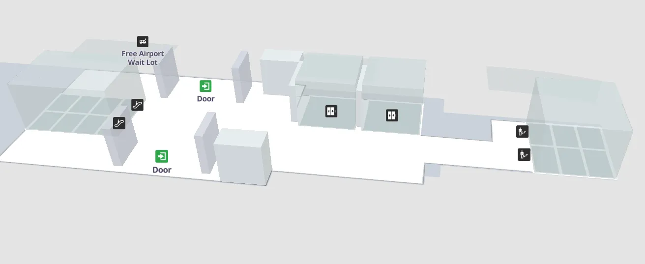
In 2024, John F. Kennedy International Airport’s Lefferts Boulevard Station introduced a free passenger drop-off and pickup lot with complimentary AirTrain service to all terminals.
From July 1 through Labor Day, the AirTrain single-ride fare at Lefferts Boulevard was reduced to $4.25 as part of a temporary summer fare adjustment.
Later in the year, AirTrain service at the station was suspended from November 12 to 13 for scheduled maintenance, with free shuttle buses provided to terminals and other stations.
John F Kennedy International Airport Lefferts Blvd Station Lower Level Map 2025-2024
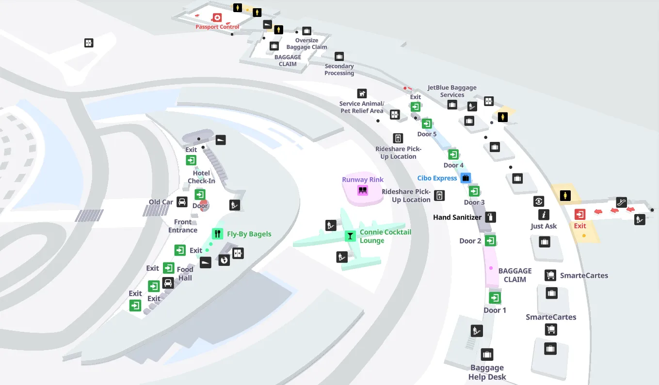
John F Kennedy International Airport Terminal Parking Map 2025-2024
In 2024, John F. Kennedy International Airport terminal parking saw multiple major changes. The Terminal 1 Parking Garage was permanently closed to support New Terminal One construction.
Overall parking capacity decreased by 3,500 spaces during rebuilding, while parking fees at garages and long-term lots were adjusted to encourage use of remote lots.
A new remote ride-share pickup lot opened on June 26 with continuous free shuttle service, and peak period parking rates were introduced across terminal facilities later in the year.
John F Kennedy International Airport Terminal Parking Illustration Map 2025-2024

Printable John F Kennedy International Airport Terminal Map PDF 2025-2024
What is the exact curb/door location at Terminal 4 Arrivals where passengers board the Lot 66 Ride App shuttle?
The Lot 66 Ride App shuttle boards on Terminal 4 Arrivals (Level 1) at the central inner-lane bus stop zone signed “Ride App / Car Services Pick-Up Shuttle,” not at the outer curb where private pickups cluster. The highest-risk mistake is boarding a different coach-style service that loads in the same frontage band.
Follow the Arrivals Hall flow out of the Customs/arrivals doors into the curb area, then stay in the inner lane where Port Authority transit buses load and scan for the dedicated “Ride App / Car Services Pick-Up Shuttle” sign. Use Pillar C4 as your “do-not-assume” landmark: other bus services often use that pillar area, so verify the destination text on the bus headsign before you step on.
What is the exact in-terminal walking route from Terminal 5 baggage claim to the AirTrain skywalk entrance (the first “must-not-miss” junction)?
The correct route goes from Terminal 5 baggage claim to the central escalator/elevator banks, up to Level 4, and directly into the enclosed Skywalk entrance for AirTrain. The must-not-miss junction is choosing the central vertical core instead of drifting to the far-right elevator bank that primarily serves the TWA Hotel.
| Step | Landmark triangulation | Move | Typical time |
|---|---|---|---|
| 1 | Baggage claim hall, facing the main exit doors | Stay centered in the hall; aim for the main (central) escalator/elevator banks | 1–2 min |
| 2 | Central escalator/elevator banks | Go up to Level 4 (Skywalk level), not street level | 1–3 min |
| 3 | Level 4 corridor leading to the enclosed bridge | Enter the Skywalk immediately and follow it toward the AirTrain station | 2–4 min |
| 4 | End of Skywalk at the AirTrain station footprint | Continue forward to the platform access | 2–4 min (beyond Skywalk) |
Total benchmark: ~6–10 minutes from baggage claim to platform in normal flow, longer if moving walkways are down or the bridge is congested.
What is the exact AirTrain stop + exit path at Howard Beach that leads to the Ride App & Car Services pickup lot (the first correct stair/elevator choice)?
Howard Beach AirTrain Station exits to the Ride App & Car Services pickup by following the station exit labeled “Ride App Pick Up & Long Term Parking,” passing through the correct fare gates, and entering Long Term Parking Lot C rather than heading toward the Subway/A-train side. The first critical choice is taking the stairs/elevator down to the parking-side exit, not the subway mezzanine flow.
From the AirTrain platform at Howard Beach, go down to the concourse level and follow the dedicated wayfinding for “Ride App Pick Up & Long Term Parking.” Use the visual split as your anchor: MetroCard machines and “Subway” signage pull crowds in one direction, while the rideshare route is explicitly labeled for pickup/parking. Pass through the gates for the station exit and continue into Lot C, where the app will direct you to numbered pickup spaces; if you see subway turnstiles or payment machines, you’ve followed the wrong stream and need to reverse to the Ride App/parking exit.
What is the minimum walking distance (feet/meters) from Terminal 4 main security exit to the furthest common B-gate cluster (distance-shock benchmark)?
The minimum walking distance from Terminal 4’s main security exit to the furthest common B-gate cluster is about 2,800 feet (≈850 meters) to the high-numbered B gates near Gate B55. That benchmark is the “distance-shock” reality check for anyone assuming Terminal 4 is compact.
From the central security area in the headhouse, the route is a straight, linear walk down Concourse B with no internal people-mover to bail you out. Use Gate numbering as your progress meter: the farther you push past the mid-B gates toward the B40–B55 end, the more the walk time compounds when moving walkways are down or foot traffic is dense. Airport signage commonly posts 15–18 minutes to the far end, but the practical pacing for many travelers with bags lands closer to a 20–25 minute gate walk.
Where is the “downstairs / alternate” Terminal 4 security checkpoint entrance located relative to the main checkpoint (single decision point a map can verify)?
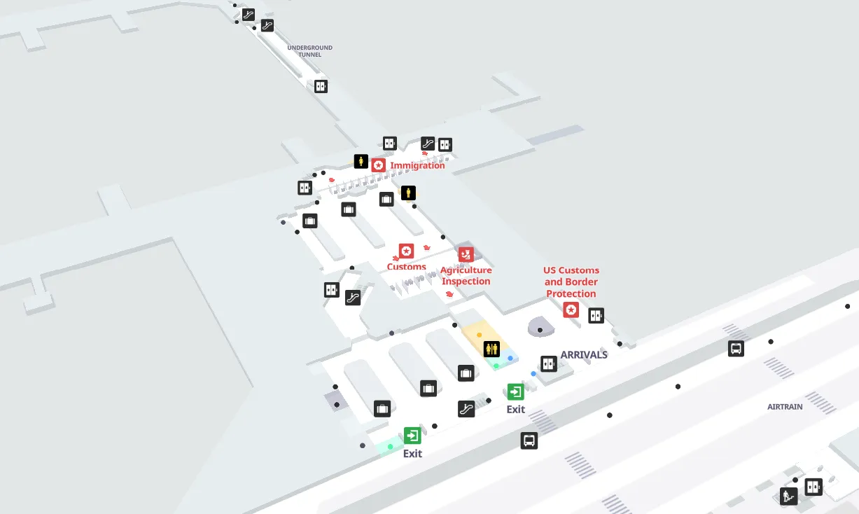
The downstairs/alternate Terminal 4 security checkpoint is on Arrivals Level 1 near the Customs/arrivals exit area, reached by following “Connecting Flights” wayfinding instead of going up to the main Level 3/4 security zone. The decision point is choosing a Level 1 entrance path near the arrivals flow rather than committing to the escalators/elevators up to departures.
Relative to the main checkpoint, which most passengers reach after moving up to the departures/check-in level, the alternate checkpoint sits one vertical stratum below and closer to the post-arrival circulation. Use the Customs exit/Arrivals Hall retail zone as your anchor: once you’re in that landside arrivals environment, look for “Connecting Flights” signage that keeps you on Level 1 and funnels you to a separate screening entrance. Expect a “standard screening” experience more often than full PreCheck/CLEAR behavior, so treat it as a tactical bypass only when the upstairs queues are extreme.
What is the exact AirTrain loop direction (terminal order sequence) required to go from Terminal 8 → Terminal 4 without riding the “long way around”?
The direct terminal-order sequence is Terminal 8 → Terminal 7 → Terminal 5 → Terminal 4 on the reverse-direction AirTrain (often shown as the clockwise/“yellow” terminals train). The dealbreaker is a suspended reverse-direction service: if that train isn’t running, you cannot ride straight from Terminal 8 to Terminal 4 without orbiting via Federal Circle.
| Option | Terminal order you’ll ride | What “long way around” means |
|---|---|---|
| Reverse-direction terminals train | T8 → T7 → T5 → T4 | Multi-stop, still direct between terminals |
| Standard-direction lines | T8 → Federal Circle → T4 (after switching to an inbound train) | Forced detour away from terminals, platform swap at Federal Circle |
What is the exact post-arrival path from Terminal 4 baggage claim to the correct rideshare decision split (“frontage pickup” vs “Lot 66 shuttle”) based on the time window signage?
The split happens at Terminal 4 Arrivals (Level 1) when you exit into the Arrivals Hall and reach the doors to the curb: signage and enforcement flip rideshare access by time window, sending ride apps either to the frontage curb (open window) or to the Lot 66 shuttle stop (restricted window). The irreversible mistake is walking to the wrong curb zone and assuming you can “just wait” for an Uber there.
From baggage claim, follow the main flow toward the Arrivals Hall exit doors and look for the ride-app restriction messaging before you commit to a curb lane. If the frontage is open (02:01 AM–11:59 AM), continue out to the standard ride-app pickup frontage area. If it’s restricted (12:00 PM–02:00 AM), do not hunt for an Uber at the outer curb; instead, stay oriented to the central inner-lane bus stop area signed for “Ride App / Car Services Pick-Up Shuttle” and board the Lot 66 shuttle. Use the taxi dispatch queuing as a landmark: if you’re being pulled into taxi lines, you’ve drifted into the taxi branch rather than the ride-app branch.
What is the exact landside transfer path from Terminal 7 → Terminal 8 that minimizes backtracking (single best corridor/escalator choice)?
The fastest landside transfer is the direct sidewalk walk along the terminal frontage roads from Terminal 7 to Terminal 8, using marked crosswalks instead of waiting for AirTrain headways. The best “no-backtrack” choice is to exit Terminal 7 to the curbside frontage and commit immediately to the sidewalk in the Terminal 8 direction rather than detouring toward the AirTrain stairs.
From Terminal 7, go out to the landside curb area and locate the pedestrian sidewalk that parallels the roadway ring between the terminals. Use the terminal frontage signage as your anchor: keep Terminal 8 in sight as the next adjacent terminal and stay on the sidewalk the whole way, only crossing at painted crosswalks. The benchmark is about 5–8 minutes on foot in normal conditions; if you’ve already climbed toward the AirTrain station entrance and see the train pulling away, you’ve likely added unnecessary vertical and platform backtracking versus the direct curbside walk.
Where are the highest-risk “wrong pickup” zones at JFK terminals where travelers report being redirected by hustlers (specific curb areas a map can mark)?
The highest-risk zones are the Terminal 4 Arrivals Hall immediately after the Customs exit and the curbside sidewalk just outside the arrivals doors before the official taxi dispatch podium. Those are the “soft zones” where travelers pause, scan signs, and are most likely to be intercepted and steered away from official lines.
Use these map-markable hotspots:
- Terminal 4 Arrivals Hall “post-Customs” greeting area where crowds compress and people stop to orient near retail/food nodes.
- Terminal 4 arrivals curb directly outside the doors, before you reach the fixed taxi dispatcher position at the curb.
- Any drift path toward short-term parking/garage access from arrivals curb areas, because hustlers often pivot travelers away from official stands into garages.
The reliable tell is behavior, not branding: official taxi dispatchers stay at a fixed curb podium and do not solicit inside, and app-based rideshare never starts with a verbal offer from a stranger.
What is the exact shuttle travel time range (minutes) from Terminal 4 → Lot 66 as routed on airport diagrams (not anecdotal), including the shuttle’s airport-road path?
The routed shuttle travel time from Terminal 4 to Lot 66 is about 10–15 minutes of driving on airport service roads, before you add curb wait and lot navigation. The practical end-to-end penalty from “I reach the curb” to “I find my pickup stall” is roughly 18–28 minutes when you include walk-to-stop, boarding, and the final lot walk.
The shuttle path is short in distance but slow in execution because it runs a loop on internal airport roads with traffic signals and merges, not a straight shot. Anchor your expectations at the decision point: once you commit to the “Ride App / Car Services Pick-Up Shuttle” at the Terminal 4 arrivals frontage, you’re entering a multi-stage process—loading, loop drive, then Lot 66 stall-finding—so treat the shuttle ride itself (10–15 minutes) as only the middle leg, not the total cost.
What is the exact connector location inside Terminal 4 for moving A concourse → B concourse without overshooting the midpoint (one junction to verify)?
The only reliable A↔B connector that avoids walking back through the headhouse is the airside Delta shuttle (“jitney”) stop at Gate A9, which links to Concourse B stops at Gate B23 (near end) and Gate B54 (far end). The junction to verify is the Gate A9 area, because that’s where you either commit to the shuttle or resign yourself to the long concourse walk.
From Concourse A, walk toward the A9 gate zone and look for the posted shuttle stop signage rather than continuing past it deeper into A gates. If you miss A9, you’ve effectively overshot the best connector and will backtrack through the same corridor to reach it. On the B side, choose B23 if you’re aiming for the proximal/mid B gates, and choose B54 if your target is the far B40–B55 cluster; picking the wrong B stop creates the same “linear penalty” as walking the whole concourse.
What is the exact AirTrain platform access point at Terminal 4 (which level/escalator bank) that most directly reaches the train without looping through check-in?
The Terminal 4 AirTrain station is accessed from Departures Level 3 via the central escalator/elevator banks up from Arrivals, entering near the large glass atrium that bridges the roadway. The most direct move is to go up to Level 3 first, then follow AirTrain signage straight into the station entrance, rather than drifting laterally through the check-in hall.
From Arrivals Level 1, take the central vertical cores (escalators/elevators) up two levels to Departures Level 3 and orient yourself on the middle of the headhouse footprint. Use the glass atrium structure as your triangulation point: the AirTrain entrance aligns with that central architectural feature. If you find yourself weaving through airline counter lines or deep into check-in queuing lanes, you’ve likely taken a lateral “check-in loop” instead of the direct AirTrain approach.
What is the exact location where Terminal 5 passengers re-enter the terminal after reaching the rideshare pickup plan (the “return-to-terminal / wrong-level” trap)?
Re-entry happens through the Terminal 5 Arrivals/Baggage Claim (Level 1) public doors you just exited, because the vertical cores to the AirTrain Skywalk are inside the terminal. The trap is trying to “stay outside” at street level—construction barriers block any clean pedestrian path to the AirTrain from the curb.
After you exit baggage claim to the sidewalk and see “No Rideshare Pickup” messaging, turn back to the same Level 1 arrivals doors and go back into the baggage claim hall. Once inside, aim for the central escalator/elevator banks (not the far-right TWA Hotel elevator bank) and go up to Level 4 to enter the Skywalk. If you can see curb traffic and barriers but no clear indoor escalators, you’re still on the wrong side of the building and need to re-enter before you commit to any further walking.
What is the exact “point of no return” in Terminal 4 where choosing the wrong level forces a full backtrack to reach the correct security or ground-transport corridor?
The point of no return is crossing the one-way glass exit doors from the secure side into the public Arrivals Hall (Level 1) after Customs or post-arrival circulation. Once you pass those doors into the landside “greeting/retail” environment, any correction that requires airside access forces a full reset: go up to departures and re-clear TSA.
In practice, the irreversible choice is committing to the wrong vertical program right after arrivals: staying on Level 1 hunting for AirTrain access (which lives on Level 3) or exiting into the arrivals curb chaos when you actually need a security re-entry path. Use the Arrivals Hall crowd barrier zone as your anchor: if you’re in the “fishbowl” greeting area with retail/food nodes and you realize you need to get back airside or find an alternate security entrance, you’ve already crossed into landside logic and must route via the correct re-screening entrance rather than trying to turn around through the one-way doors.