Tocumen International Airport Map (Most Up-To-Date)
Tocumen International Airport is a split, two-terminal complex with Terminal 1 (North) and Terminal 2 (South) connected by an indoor corridor (“Connector”) plus an external landside shuttle. The practical layout is long and linear at the curb, with key decision points on Arrivals (Level 100) at Door 2 (Terminal 1) and Door P17/Door 17 (Terminal 2). Most first-timer confusion happens on the landside side within Panama City’s primary airport hub, not airside.
Map Table
| Terminal | Landside transfer anchors | Rideshare rule | Metro access |
|---|---|---|---|
| Terminal 1 (North) | Door 2 (Level 100) | Short-Term Parking only | via Connector corridor (long) |
| Terminal 2 (South) | Door P17 / Door 17 (Level 100) | Parking Rows 15–18 only | Estación Aeropuerto in Connector |
Tocumen International Airport Map Strategy
- Treat Door 2 (Terminal 1) and Door P17/Door 17 (Terminal 2) as the only reliable “transfer coordinates” for the landside shuttle; if you aren’t standing at those doors, you’re effectively not in the system.
- Decide walk vs shuttle early: the indoor Connector can be physically long door-to-door, while the shuttle can cost you a full headway cycle; pick the option that keeps you in control of your timeline.
- For rideshare, skip the arrivals curb entirely and commit to the parking-lot protocol (Terminal 2 Rows 15–18, Terminal 1 Short-Term Parking) before you request the car to avoid cancellations and enforcement issues.
- From the Metro, stay on the covered Connector approach toward Terminal 2, then use door-number landmarks on Arrivals (Level 100) to avoid wrong-elevator/wrong-curb mistakes.
2026 Tocumen International Airport Map + Printable PDF
Current operations at Tocumen International Airport still hinge on Terminal 2 as the modern processing core (including international baggage handling patterns that can push arriving passengers toward Terminal 2 even after a Terminal 1 gate arrival). Landside wayfinding remains “door-number dependent,” and rideshare enforcement continues to push pickups into parking (not the curb), so a printable 2026 map is most useful when it highlights Door 2 and Door P17.
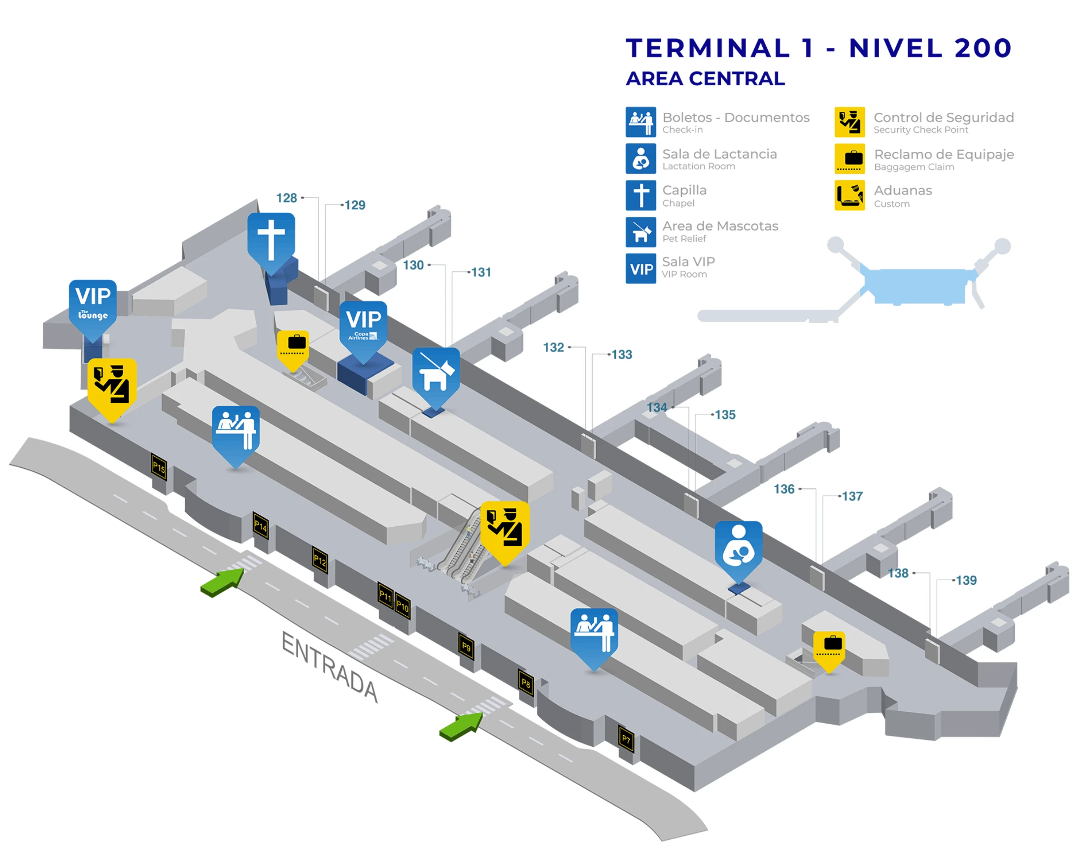
Tocumen International Airport Terminal 1 Nivel 100 Map 2026
Tocumen International Airport Terminal 1 Nivel 200 Map 2026
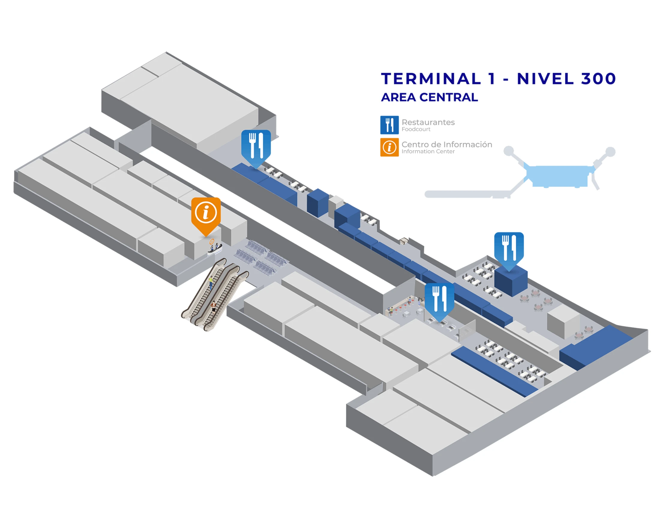
Tocumen International Airport Terminal 1 Nivel 300 Map 2026
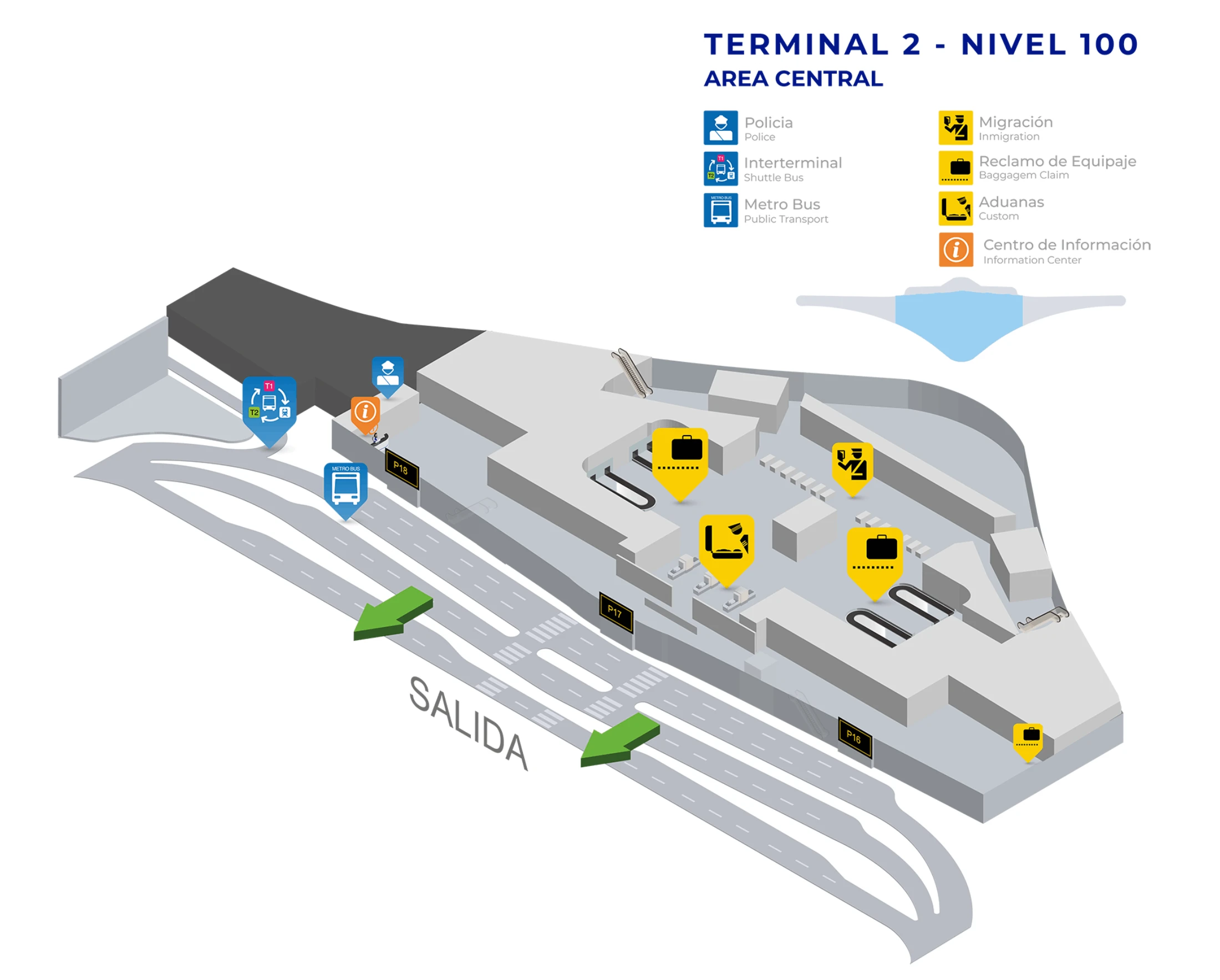
Tocumen International Airport Terminal 2 Nivel 100 Map 2026
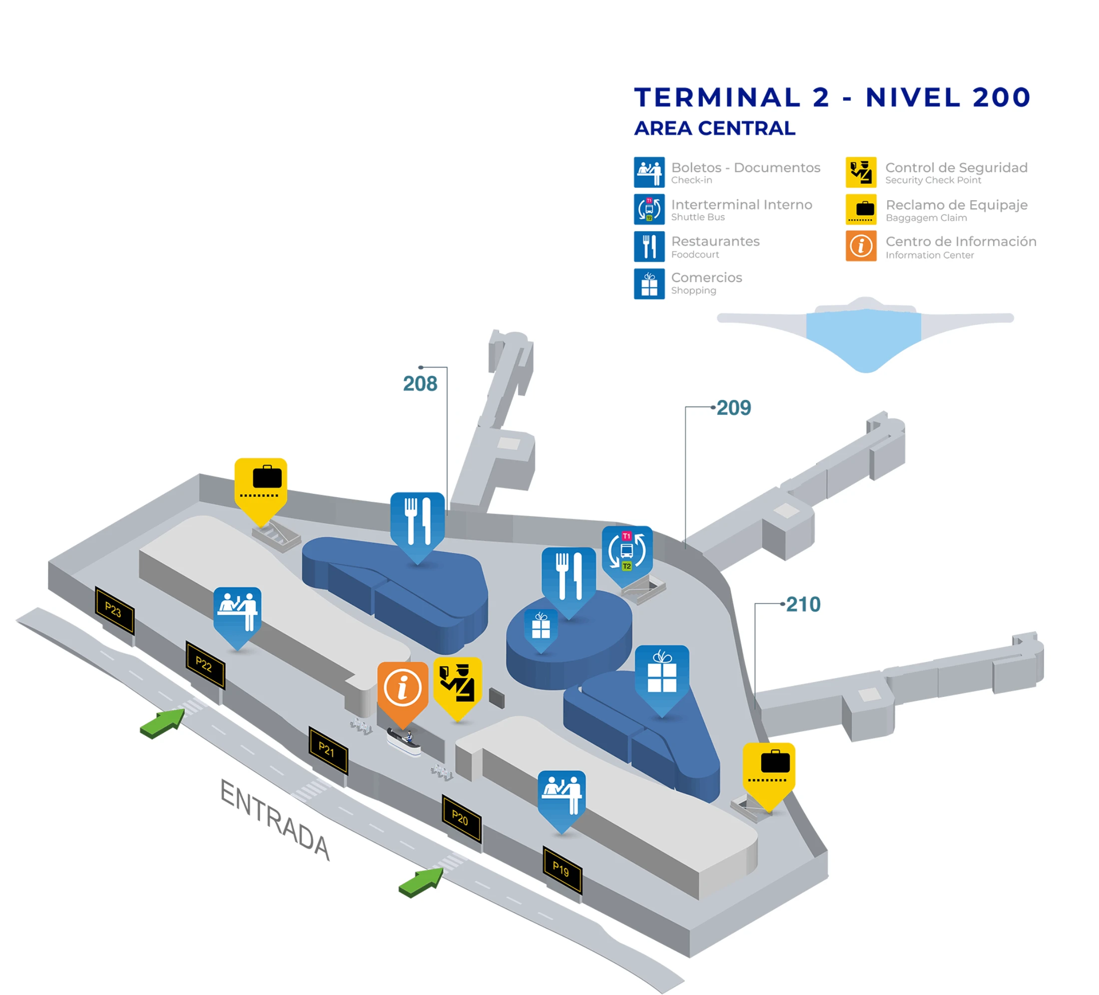
Tocumen International Airport Terminal 2 Nivel 200 Map 2026
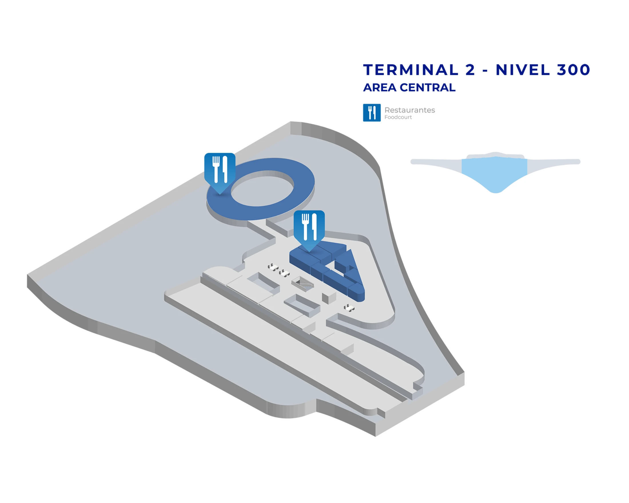
Tocumen International Airport Terminal 2 Nivel 300 Map 2026
2026 Tocumen International Airport Map Guide
What is the exact walking distance (meters) from Terminal 2 international arrivals exit to the P17 door/area shuttle/bus stop used for Terminal 1 transfers?
The walking distance is approximately 20–50 meters, because Door P17 sits on the Terminal 2 Arrivals frontage (Level 100) near the ground-transport doors. From the international arrivals exit flow, stay on Level 100 and track toward the P17/P18 door bank rather than changing levels.
Use this as your micro-route: exit into the public arrivals hall, follow the door-number signage toward P17 at the far end of the terminal frontage, and stop at the curb directly outside Door P17 where the landside terminal-transfer shuttle boards. Avoid drifting toward taxi queues or crossing the roadway, which puts you in the wrong pickup flow.
Where is the Terminal 2 → Terminal 1 transfer shuttle stop located relative to Door P17 (which side of the exit flow / curb)?
The shuttle stop is on the inner curb directly outside Door P17 on Terminal 2 Arrivals (Level 100), not across the roadway. Door P17 is the landmark—if you can see the P17 door label on the terminal frontage, you are already at the correct boarding area.
Stay with the terminal-side curb flow: exit through Door P17, remain on the sidewalk against the terminal façade, and look for shuttle/bus signage on the pillars at that curb. Do not cross the street toward the parking structure or outer lanes; that puts you into the private-car/taxi circulation and forces a backtrack to reach the shuttle loading curb.
What is the exact walking distance from the Terminal 1 shuttle drop-off to the Terminal 1 check-in counters (fastest indoor route)?
The walking distance is approximately 100–150 meters, because the shuttle drops at Door 2 on Terminal 1 Arrivals (Level 100) and check-in is one level up on Departures (Level 200). The fastest route is short but vertical, and elevator/escalator wait time is what usually stretches the transfer.
Enter Terminal 1 through Door 2, walk about 30–50 meters to the nearest escalator/elevator bank, go up to Level 200, then walk straight across the check-in hall to your airline’s counter island. Use Door 2 as your anchor point—if you exit the shuttle and drift along the curb outside, you’ll lose the quickest path to the vertical core.
What is the exact walking distance from Terminal 1 check-in to the primary security checkpoint used after a Terminal 2→Terminal 1 baggage re-check?
The walking distance is approximately 50–100 meters, because Terminal 1’s Departures (Level 200) check-in hall and its main security checkpoint sit close together in the legacy layout. The key is staying on Level 200 and aiming for the central security entry rather than walking the length of the façade.
From your check-in counter position, orient toward the main central security lanes on the same level, using the densest queueing stanchions and overhead “Security/Seguridad” signage as the visual landmark. If you find yourself at windows facing the curb or drifting toward far-end counters, you’ve overshot; cut back toward the middle of the hall to reach the primary checkpoint fastest.
At Terminal 2, what is the precise rideshare pickup point for “Door 17” (which curb/level/door bank on the terminal frontage)?
The pickup point is not the Door 17 curb; rideshare pickups are in the parking structure across the roadway, typically in Parking Rows 15–18 aligned opposite the Door P17/P18 door bank on Arrivals (Level 100). Door 17 is the navigation anchor that gets you to the correct crosswalk, not the legal loading curb.
Exit Terminal 2 Arrivals through Door P17 or P18, use the pedestrian crosswalk directly in front of those doors to cross the arrivals roadway, then enter the parking area and walk toward the higher-numbered row signage until you reach Rows 15–18. Request the ride after you are in the parking area so your pin and timing match the driver’s parking-lot entry window.
At Terminal 1, what is the exact pedestrian route (turn-by-turn landmarks) from the customs exit doors to the short-term car park rideshare meeting spot?
The route is a straight curb-to-crosswalk move from the Terminal 1 Arrivals customs exit to Short-Term Parking across the roadway, because rideshare pickups are not allowed on the arrivals curb. The quickest path ends in the open-air short-term lot where GPS and data are more reliable than under the terminal canopy.
Exit customs into the Arrivals hall (Level 100), head to the main glass exit doors near Door 2, and walk out under the concrete overhang. Ignore the taxi solicitation cluster and look for the marked pedestrian crosswalk directly ahead across the pickup lanes. Cross the roadway into the area signed for Short-Term Parking (Estacionamiento de Corta Estancia), then stop in the parking aisles near visible landmarks like pay stations or row markers before requesting the ride.
Where exactly are the Uber-designated pickup rows/parking lots 15–18, and what is the shortest walking path from Terminal 2 arrivals exit to those rows?
Rows 15–18 are inside the Terminal 2 parking area across the arrivals roadway, positioned toward the far-right side of the lot when you leave the terminal and face away from the building. The shortest path starts at the Door P17/P18 exit bank on Arrivals (Level 100) because that is where the most direct crosswalk lines up with the parking entrance.
Exit Terminal 2 Arrivals via Door P18 (or P17), immediately use the pedestrian crosswalk in front of those doors to cross the roadway, then enter the parking structure/lot. Once you’re in the lot, turn right toward the higher-numbered row signage and walk until you reach Rows 15, 16, 17, and 18. Don’t request the Uber while still under the terminal frontage—walk into the lot first so the app anchors you to the correct rows.
Where are the Zona 1–6 pickup zones physically located at Tocumen International Airport, and which zones correspond to the rightmost curb segment referenced as “Zona 5 or 6”?
Zona 1–6 are the numbered pickup islands/curb segments on the Terminal 2 arrivals frontage just before the parking-lot entrance, and Zona 5–6 are the rightmost segments when you are facing away from the terminal. Those zonas can work as a human meeting reference, but they are not the legal rideshare load point if the app is directing the driver into the parking rows.
Use the Door P17/P18 door bank as your anchor: walk outside on Arrivals (Level 100) and look along the terminal-side curb where the zones are numbered in sequence. The “rightmost” reference aligns closest to Zona 6, which sits nearest the approach into the parking area that leads to Rows 15–18. If your driver is going to Rows 15–18, treat Zona 5/6 as the last curb landmark before you cross the roadway into the parking pickup rows.
What is the exact walking distance from the Metro airport station exit to the Terminal 2 entrance, and how much of that route is currently covered vs uncovered?
The walking distance is approximately 200–300 meters, and the route is effectively 100% covered via the purpose-built walkway linking Estación Aeropuerto to the Terminal 2 side. The practical time budget is about 5–8 minutes at a normal pace, mainly depending on crowding and luggage speed.
From the station exit at street-level walkway, stay on the Connector-side pedestrian path aimed toward Terminal 2’s façade rather than dropping into curb lanes. The covered route functions like a corridor: once you’re on it, you should not need to cross open roadway until you choose a specific curb/door on Arrivals (Level 100). If you find yourself in direct sun/rain, you’ve likely left the intended covered spine.
From the Metro airport station, where is the specific elevator exit mentioned, and what is the shortest path from that elevator to the shuttle waiting sidewalk for terminals?
The elevators are at the Estación Aeropuerto entrance/exit block on the station’s street-level access point, and the shortest path from that elevator to the shuttle is to follow the covered Connector walkway to Terminal 2 Arrivals and then stand at Door 17 (Door P17) on the terminal-side curb. Door P17 is the shuttle anchor on the Terminal 2 end.
After you exit the elevator at the station’s ground-level walkway, turn toward the Terminal 2 direction of travel on the covered path, continue until you reach Terminal 2’s arrivals frontage, then locate the P17/P18 door bank signage. The shuttle waiting sidewalk is directly outside Door P17 on the inner curb; do not cross the roadway toward the parking structure if your goal is the terminal-transfer shuttle rather than rideshare pickup.
Where are the known “no data / weak signal” curb areas around the Terminal 1 customs exit, and what is the shortest walk to a spot with reliable signal for rideshare requests?
The weak-signal zone is immediately outside the Terminal 1 Arrivals glass doors under the heavy concrete overhang at the curb, and the shortest reliable-signal move is to cross the roadway into the open-air Short-Term Parking area. Open sky and distance from the terminal canopy improve GPS lock and mobile data stability for rideshare matching.
Exit customs to Arrivals (Level 100), go out through the main doors near Door 2, and keep walking past the canopy edge until you reach the marked pedestrian crosswalk. Cross into Short-Term Parking and stop in a clear aisle near a visible landmark like payment machines or row markers before requesting the ride. If your pin keeps drifting or the app stalls, you’re still too close to the building overhang.