Plattsburgh Airport Terminal Map
Location: Plattsburgh, New York
Welcome to the ultimate guide for navigating Plattsburgh Airport Terminal Map!
Plattsburgh International Airport (PBG) is a county-owned public airport located 3 nautical miles south of Plattsburgh, New York. It features a 11,759-foot runway, expanded passenger terminal, and serves as a strategic gateway to the Adirondacks, Montreal, and Lake Champlain areas.
Get ready for an exciting adventure as you prepare for your trip. This handy map highlights essential spots like the popular Adirondack Coast Visitor Center and the cozy Sun & Ski Inn and Suites. With a clear layout, finding your way to dining options or rental services is a breeze.
Dive into the details and start your journey on the right foot at Plattsburgh Airport!
PBG Airport Terminal – Level 1 Map 2024

PBG Airport Terminal – Level 2 Map 2024

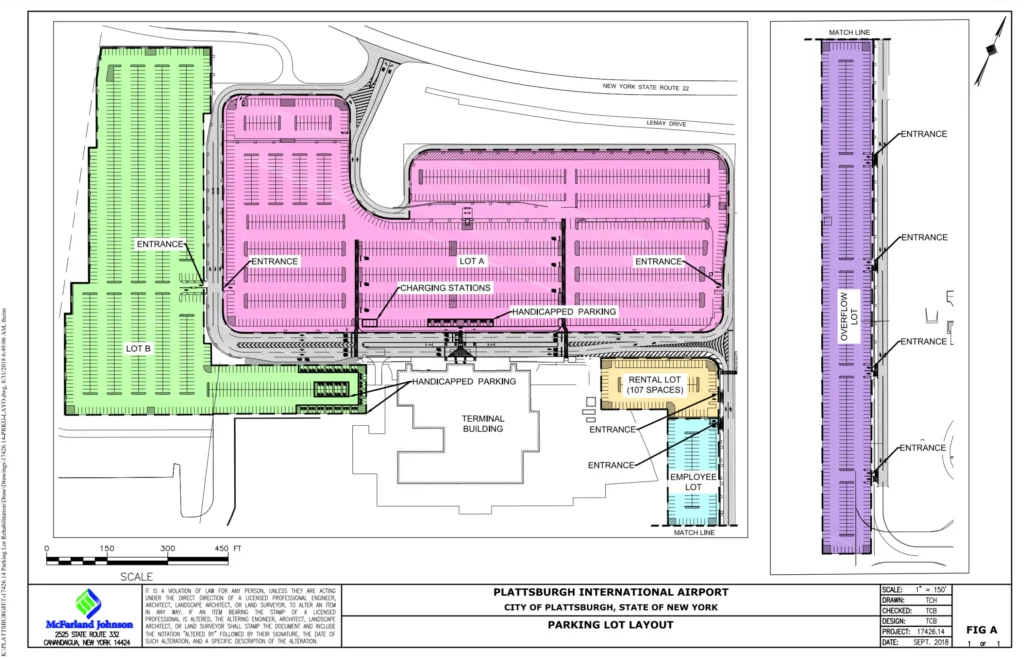
PBG Airport Terminal Parking Map 2024

FAQ
What airlines operate out of Plattsburgh, NY?
Plattsburgh International Airport (PBG) serves airlines like Allegiant Air and Sun Country Airlines, offering non-stop flights to destinations including Florida and Las Vegas.
How big is Plattsburgh airport?
Plattsburgh International Airport covers approximately 1,200 acres, featuring a single runway and a terminal that handles both domestic and international flights.
What is the new airline at Plattsburgh International Airport?
The newest airline at Plattsburgh International Airport is Avelo Airlines, which launched service to popular destinations like Florida, enhancing travel options for passengers.


