Cleary University Campus Map (2025-2015)
The Cleary University Campus Map orients visitors to the layout nestled between Grand River Avenue and Grand Oaks…
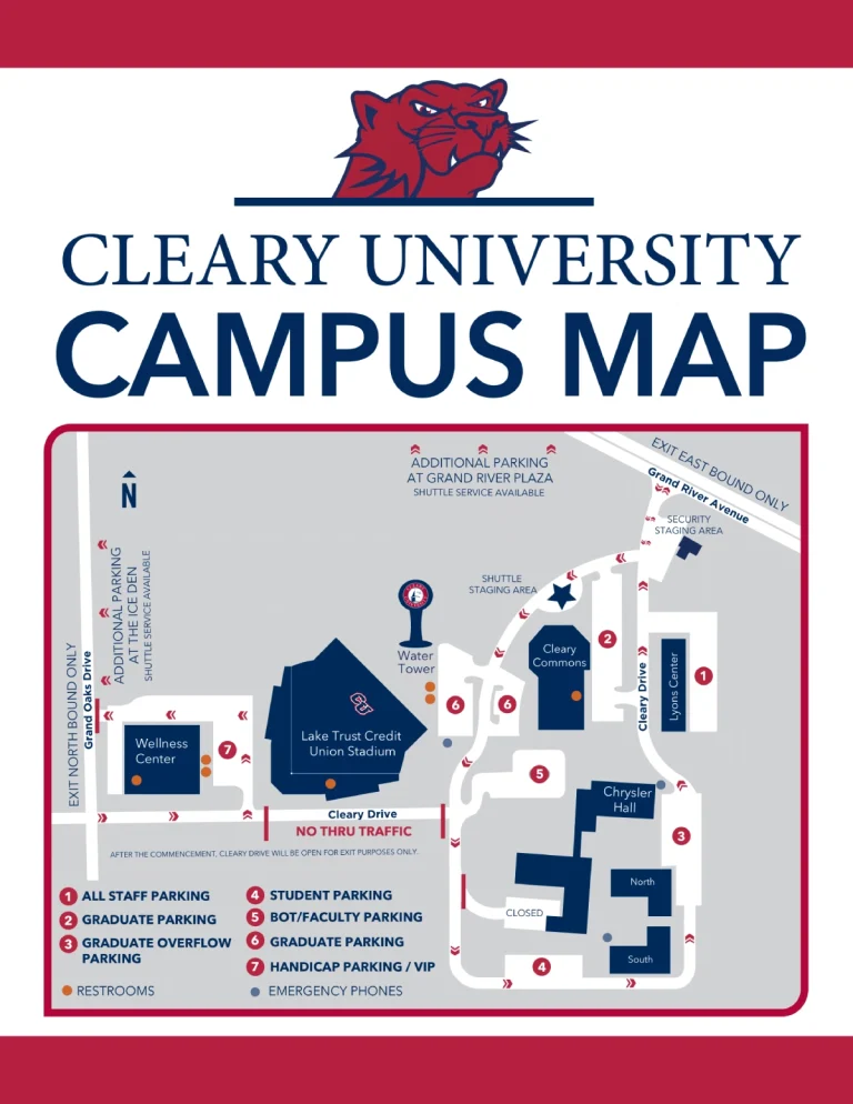
The Cleary University Campus Map orients visitors to the layout nestled between Grand River Avenue and Grand Oaks…

The Hector International Airport Ground Transportation Map maps gate locations, security points, and ground transport options in three…
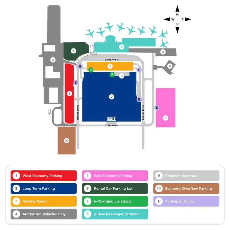
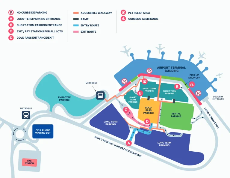
The Hector International Airport Parking Map maps parking zones, security, and ground transport in one view. Look for…
The Eugene Airport Ground Transportation Map clarifies pickup bays, rental-car access, and shuttle positions. The map highlights three…
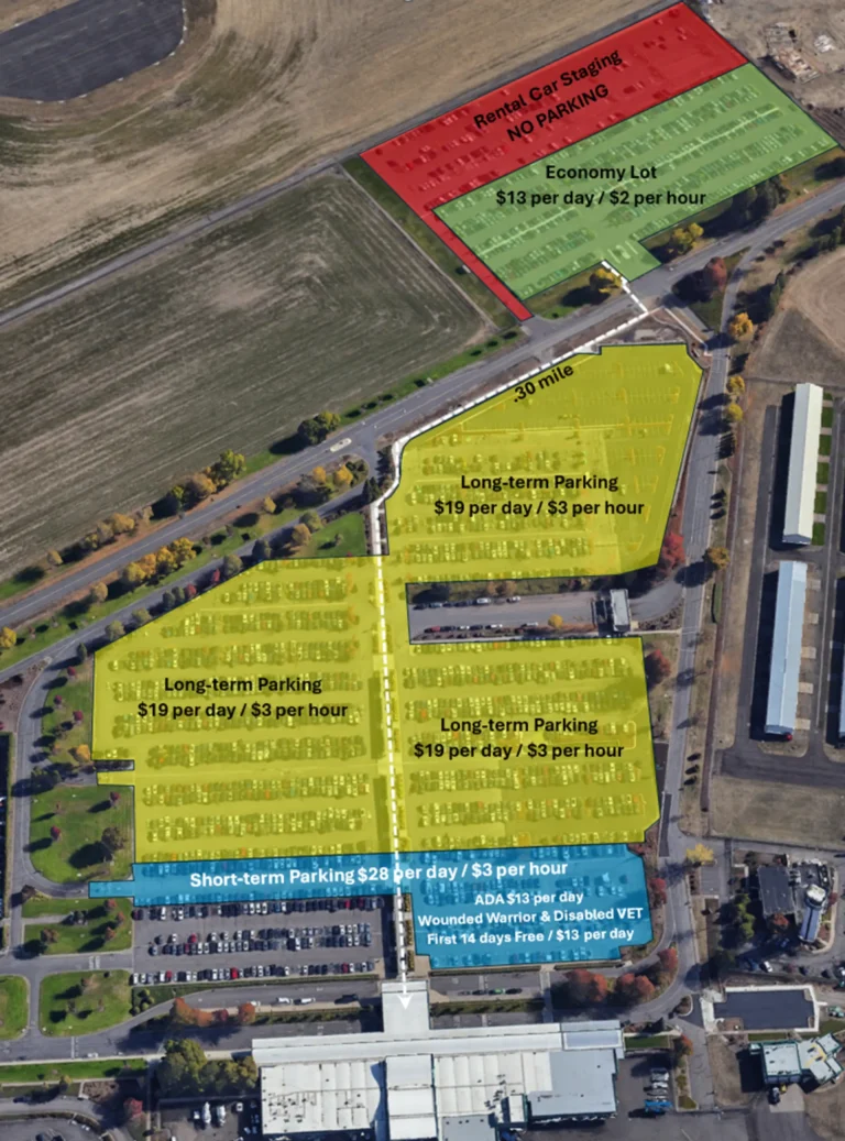
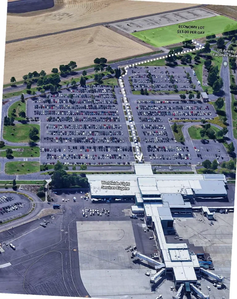
The Eugene Airport Parking Map maps short-term areas, long-term zones, and walking routes to the terminal, helping you…
Open the St. John’s International Airport Ground Transportation Map to plan your route to taxis, rental cars, and…

Amenities shape the experience at St. John’s, where a single-terminal layout keeps every service within easy reach. That’s…
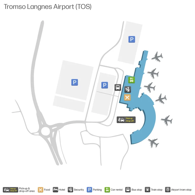
Open the Troms Airport Ground Transportation Map to plan where pickup points, walking paths, and curbside lanes sit…

Open the Troms Airport Parking Map to plan gates, security points, lounges, ground transport choices, and walking routes…
Simple enough. Congestion at the curb can still slow you down, especially when you’re juggling ride-hail pickups on…