Kahului International Airport Terminal Map (2024)
Location: Molokai, Hawaii
Planning your trip to Molokai? The Molokai Airport Terminal Map is your guide to the island’s charm.
Molokai Airport (MKK) is the primary airport serving the island of Molokai, Hawaii. It is located approximately 6 miles northwest of Kaunakakai, the island’s main town. MKK handles interisland flights, primarily from Honolulu (HNL) and Kahului (OGG), via regional carriers like Mokulele Airlines and Makani Kai Air. The airport is small and primarily caters to local travel and tourism.
Once you land, you’ll have easy access to amenities like the Molokai Airport Lounge, perfect for a relaxing start to your adventure. Explore nearby spots such as the local eateries serving fresh island fare.
Whether you’re heading to a remote beach or a cozy hotel, this map will help make your journey smoother and more enjoyable!
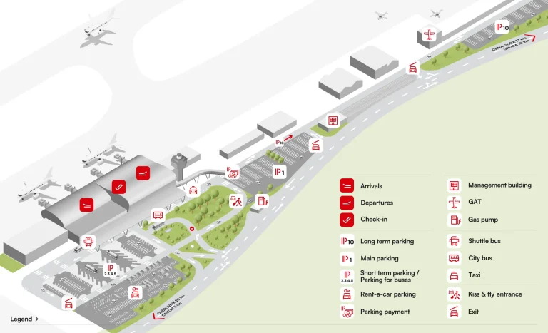
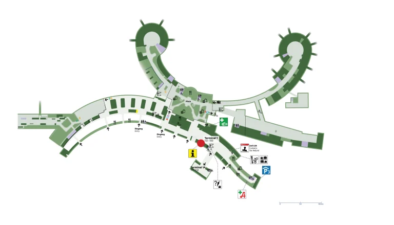
MKK Airport Terminal Layout Map 2024

FAQ
Can you get around Molokai without a car?
Getting around Molokai without a car is possible using taxis, shuttle services, bicycles, and limited public transportation. However, renting a car is recommended for flexibility and access to remote areas.
Can you fly direct to Molokai?
Direct flights to Molokai are available from Honolulu and Maui through regional airlines. There are no direct flights from the U.S. mainland or international destinations.
How many airlines fly to Molokai?
Two airlines, Mokulele Airlines and Makani Kai Air, currently operate flights to Molokai from neighboring Hawaiian islands.
How do I get from OGG to Molokai?
To travel from OGG (Kahului Airport) to Molokai, book a short interisland flight with Mokulele Airlines. The flight typically takes about 30 minutes.