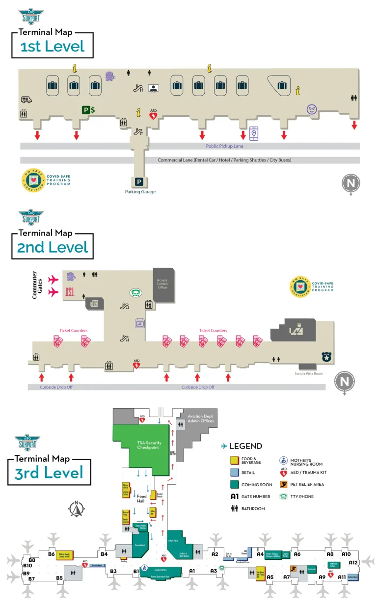
Denton Airport Terminal Map
Location: Denton, Texas
Discover the ease of navigating Denton Enterprise Airport with the most up-to-date Denton Airport Terminal Map.
Denton Enterprise Airport (DTO) is a public-use airport located in Denton, Texas. It serves general aviation and is equipped with a 7,002-foot runway, accommodating various aircraft, including corporate jets and training planes. The airport provides services like fueling, hangar rentals, and aircraft maintenance, supporting the aviation needs of the growing Denton area.
Planning a trip? This guide highlights key amenities like the Pilot Point Café, known for its fresh pastries and coffee, and the Executive Lounge, perfect for relaxing before your flight.
Convenient parking areas and streamlined baggage claim zones are clearly marked, ensuring a stress-free experience. Whether you’re flying for business or leisure, this map makes every moment of your journey effortless.
DTO Airport Terminal Overview Map 2024

FAQ
What airport do you fly into for Denton, TX?
For Denton, TX, you can fly directly into Denton Enterprise Airport (DTO) for general aviation. For commercial flights, the closest major airport is Dallas/Fort Worth International Airport (DFW), located about 25 miles south.
What time does the KDTO tower open?
The air traffic control tower at Denton Enterprise Airport (KDTO) operates daily from 7:00 AM to 9:00 PM (local time).
What is the phone number for Denton ATC Tower?
The phone number for the Denton ATC Tower is +1 (940) 349-7750.
What is the elevation of Denton Airport?
The elevation of Denton Enterprise Airport (DTO) is 642 feet (196 meters) above sea level.