Ontario International Airport Terminal 4 Map (Most Up-To-Date)
Ontario International Airport (ONT) Terminal 4 is a long, linear terminal on the east side of the facility, fronted by Terminal Way and flanked by surface parking. The building runs roughly west–east, with arrivals and curb activity stretched along a single frontage that can feel longer than it looks. Within the broader Inland Empire airport hub, the biggest navigation wins come from treating landside as an “island network” (lots, islands, curbs) and using fixed identifiers like column numbers and island curbs to avoid circling.
Map Table
| Landside Node | Closest T4 Side | Key Identifier | Typical Risk |
|---|---|---|---|
| Lot 4 | North/frontage | terminal frontage | curb congestion |
| Lot 5 | East/adjacent | East Terminal Way sidewalk | walk-distance variability |
| Rideshare pickup | Arrivals level | 2nd curb, Columns 12–13 | wrong curb/column |
| Rental car shuttle | Arrivals level | center island | stop-location uncertainty |
Ontario International Airport Terminal 4 Map Strategy
- Treat Terminal 4 as an islands-and-identifiers problem: pick your island (inner curb vs middle island vs center island) before you walk outside, then lock onto a column range to avoid curbside drift.
- Default to deterministic walking when possible: Lot 5 is walk-adjacent and beats shuttle headways when time pressure is high, but only if you exit the lot on the correct sidewalk toward the east end of the terminal.
- Assume transfer constraints first: Terminal 2 and Terminal 4 are not connected post-security, so any “quick walk inside” plan fails—plan for landside travel and a second TSA entry.
- Use negative constraints to prevent wrong turns: rideshare pickups are not at the inner curb by the doors, and the Cell Phone Waiting Lot is not accessed from simply looping the terminal—commit early to the correct diversion road.
2026 Ontario International Airport Terminal 4 Map + Printable PDF
Terminal 4 remains operational in 2026 and continues to function as a high-velocity domestic terminal with the same core landside topology: surface lots, multi-island curbs, and strict geofenced pickup rules. Current navigation friction still concentrates at the arrivals curb (where “rideshare” is not the same as “door pickup”) and in parking-lot walk variability, so a printable map is most useful when it highlights exact curb islands, column ranges, and the Lot 5 sidewalk vector.
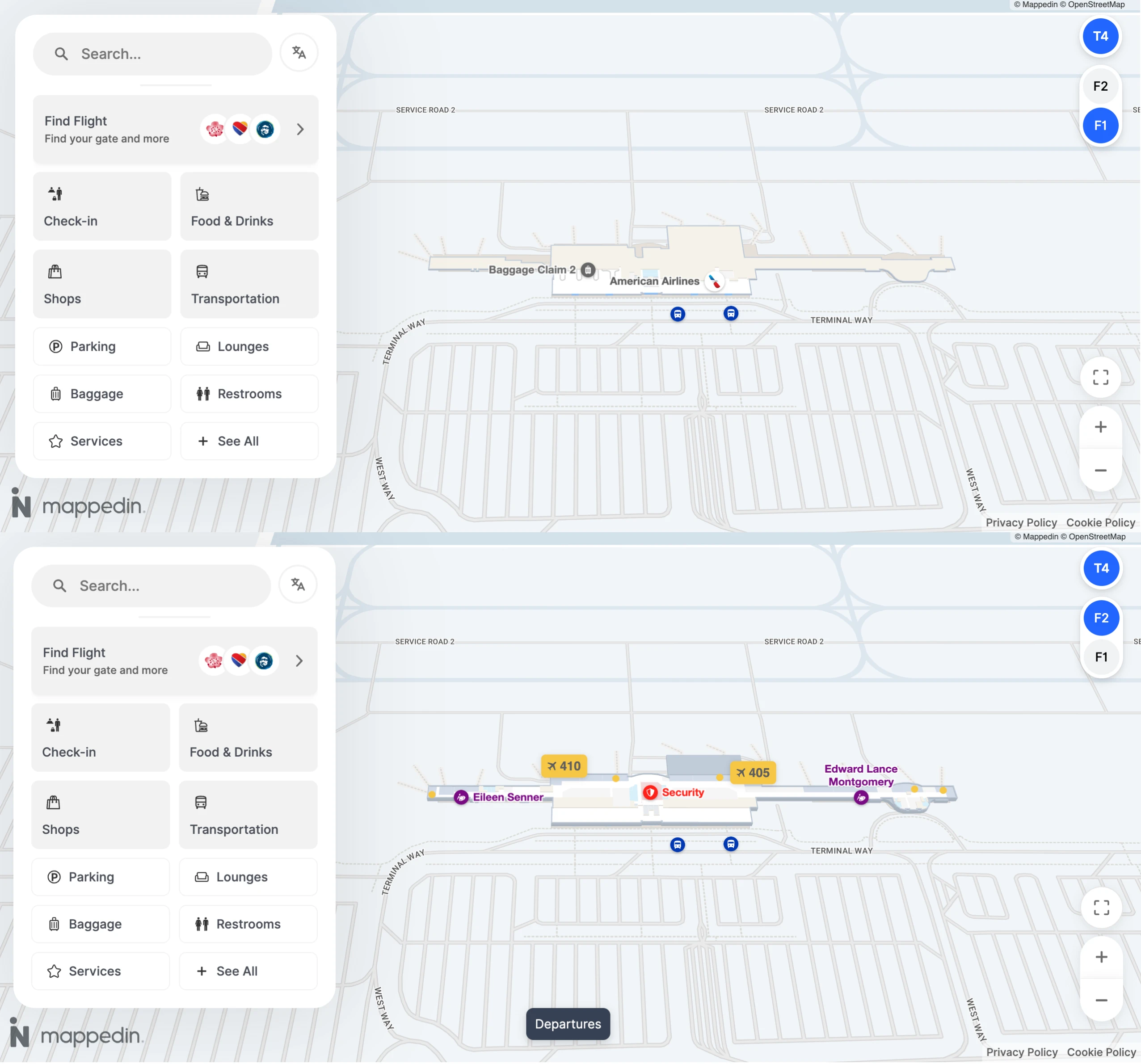
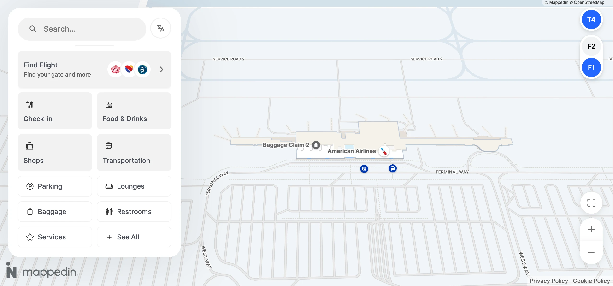
Ontario International Airport Terminal 4 Level 1 Map 2026
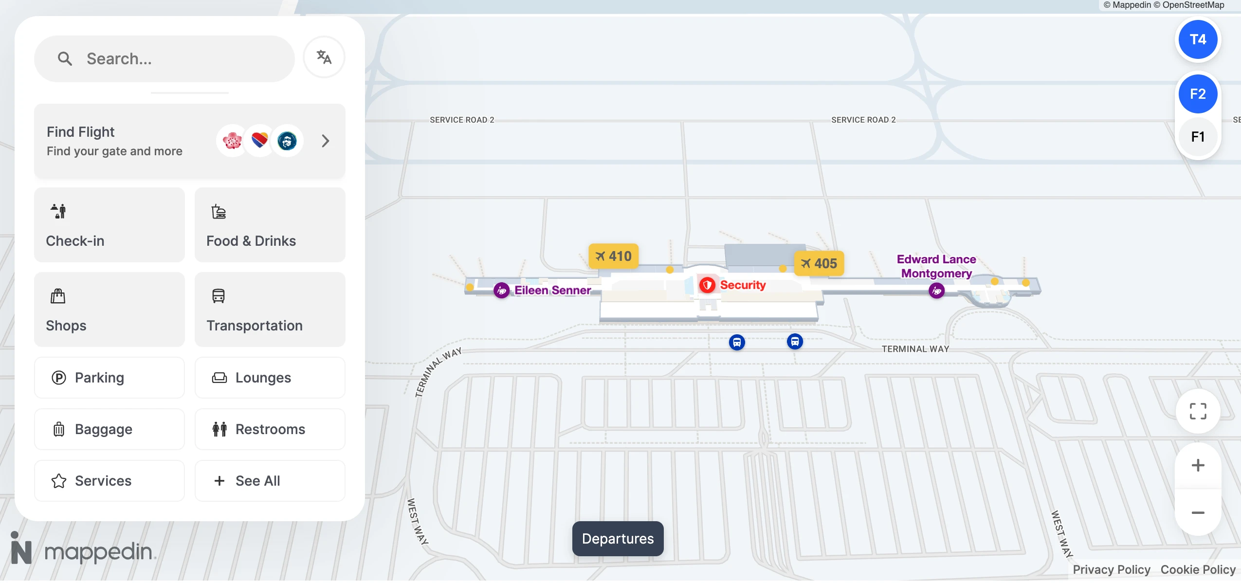
Ontario International Airport Terminal 4 Level 2 Map 2026
2026 Ontario International Airport Terminal 4 Map Guide
What is the shortest walking route from Lot 5 to the nearest Terminal 4 entrance (in feet/meters), as shown on the map?
Walking from Lot 5 to Terminal 4 takes about 500 feet (≈152 meters) on the shortest, map-verified path. The fastest route starts from the northwest quadrant of Lot 5 (the corner closest to the terminal) and uses the sidewalk along East Terminal Way to reach the easternmost arrivals/baggage-claim doors of Terminal 4.
| Start point | Route vector | End point |
|---|---|---|
| Lot 5 (northwest corner) | sidewalk along East Terminal Way | Terminal 4 east-end arrivals/baggage-claim entrance |
| Lot 5 (near rental car boundary) | same sidewalk vector | same entrance (longer walk) |
From the Terminal 4 baggage claim doors, where is the exact rideshare pickup zone (door/curb/column reference) on the map?
Rideshare pickup is at the 2nd curb (the middle island) between Columns 12 and 13 on the Terminal 4 arrivals level. From baggage claim, the correct move is to exit to the lower-level curb, cross the first roadway away from the building, and wait on the middle island aligned to the Column 12–13 markers rather than the door-side inner curb.
- Arrivals (lower) level curbside
- Middle island / 2nd curb (not the building-side curb)
- Between Columns 12 & 13
Where is the Cell Phone Waiting Lot relative to Terminal 4, and what is the cleanest map-confirmable driving path from the terminal loop to reach it?
The Cell Phone Waiting Lot sits west of the terminal core, past Terminal 2, on John Bangs Drive (3350 John Bangs Dr). It is not a spur you can reliably grab while you’re trapped inside the Terminal Way loop around Terminal 4, so the correct move is to exit the core roads and re-approach via the perimeter streets.
From the Terminal 4 loop frontage, the clean map-confirmable path is to leave Terminal Way back toward Airport Drive, then route onto Rental Car Drive to reach John Bangs Drive and the Cell Phone Waiting Lot entrance. The key decision is committing to the John Bangs/Rental Car Drive diversion before you re-enter the terminal recirculation pattern.
Where is the Terminal 4 rental-car shuttle stop located relative to baggage claim exits (which curb/side), according to the airport transport map?
The Terminal 4 rental-car shuttle stop is on the center island on the arrivals (lower) level, across the roadway from the baggage-claim doors. From baggage claim, you exit to the building-side curb first, then cross to the island in the middle of the terminal roadway where shuttle signage is posted. This placement matters because waiting at the door-side curb puts you in the private-vehicle flow, while the shuttle loads from the island infrastructure to keep buses out of the inner curb congestion.
At the International Arrivals Terminal, where is the shuttle pickup point for transfer toward Terminal 4, and what is its exact position on the map?
No airside transfer exists; the Terminal 4 transfer requires a landside shuttle pickup at the International Arrivals Terminal curb at 2222 International Way. The pickup point is the curbside loading area directly outside the International Arrivals building entrance, where the airport shuttle serves the terminal loop.
The operational constraint is that the shuttle may not stop unless you actively signal intent, so the map-true positioning is “at the curb outside 2222 International Way,” with the practical action of flagging/requesting pickup (airport shuttle line: (909) 937-1240) to prevent being bypassed.
Are Terminal 2 and Terminal 4 connected post-security by a walkable corridor, and if so, what is the map-confirmable route between them?
No post-security corridor connects Terminal 2 and Terminal 4. The map-confirmable route is entirely landside: exit the secure area of your arriving terminal to baggage claim/curb, then walk along the Terminal Way sidewalk between the two buildings and re-enter through the departing terminal’s ticketing lobby to clear TSA again.
| Segment | Landmark anchor | Constraint |
|---|---|---|
| Exit secure area | baggage claim / arrivals curb | must leave airside |
| Walk between terminals | Terminal Way sidewalk past Lot 3 | outdoor, weather-exposed |
| Re-enter & screen | Terminal 4 ticketing lobby → TSA | must re-clear TSA |
What is the precise walking distance from Terminal 4 TSA exit to the furthest listed gates in Terminal 4 (longest path), based on the terminal map?
Walking from the Terminal 4 TSA exit to the furthest gates is about 900 feet (≈274 meters) on the longest map-verified path. The route runs from the TSA recomposure/exit area into the central concourse, then straight down the single pier to the end gates (commonly the far east end, such as the 41x-range).
- Start at the TSA exit/recompose area (center of the terminal)
- Follow the main concourse down the pier (no moving walkways)
- Continue to the end-gate cluster at the far tip of the concourse
Where is the fastest pedestrian exit path from Terminal 4 to reach an offsite rideshare pickup point (the first safe/legal boundary off airport property) shown on map layers/roads?
Reaching the first practical offsite boundary on foot from Terminal 4 is fastest by walking east to Haven Avenue via Airport Drive. The clean exit path starts at the Terminal 4 arrivals (lower) level, then follows the sidewalk corridor that runs past Lot 5 and the Consolidated Rental Car Center until you hit the Haven Avenue intersection, which functions as the first clear “off-airport” edge for pickups.
From Terminal 4, exit to the landside frontage and orient toward Lot 5 (east side). Stay on the Airport Drive sidewalk as you pass the Lot 5 edge and the rental car center frontage, continuing straight to Haven Avenue. This route is roughly 0.6–0.8 miles and is shorter than walking west toward Archibald Avenue via Terminal 2 and International Arrivals.
From Lot 2 and Lot 3, what are the separate map-verified walking distances to the same Terminal 4 entrance (to quantify the distance variability problem)?
Walking from Lot 2 to Terminal 4 is about 1,500+ feet (≈457+ meters) to reach the same Terminal 4 entrance, while Lot 3 varies from about 300–800 feet (≈91–244 meters) depending on where you park. Lot 2 sits in front of Terminal 2, so the route is inherently long; Lot 3 can be short only if you park on the east side nearest Terminal 4.
| Parking origin | To the same Terminal 4 entrance | Why it varies |
|---|---|---|
| Lot 2 | 1,500+ ft (≈457+ m) | terminal-to-terminal span + Lot 3 crossing |
| Lot 3 (east side) | ~300–600 ft (≈91–183 m) | closest stalls to Terminal 4 |
| Lot 3 (west side) | ~600–800 ft (≈183–244 m) | stalls align more toward Terminal 2 |


