São Paulo Guarulhos International Airport Terminal 2 Map (Most Up-To-Date)
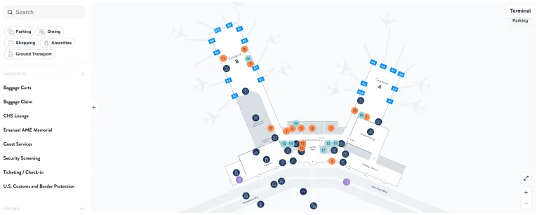
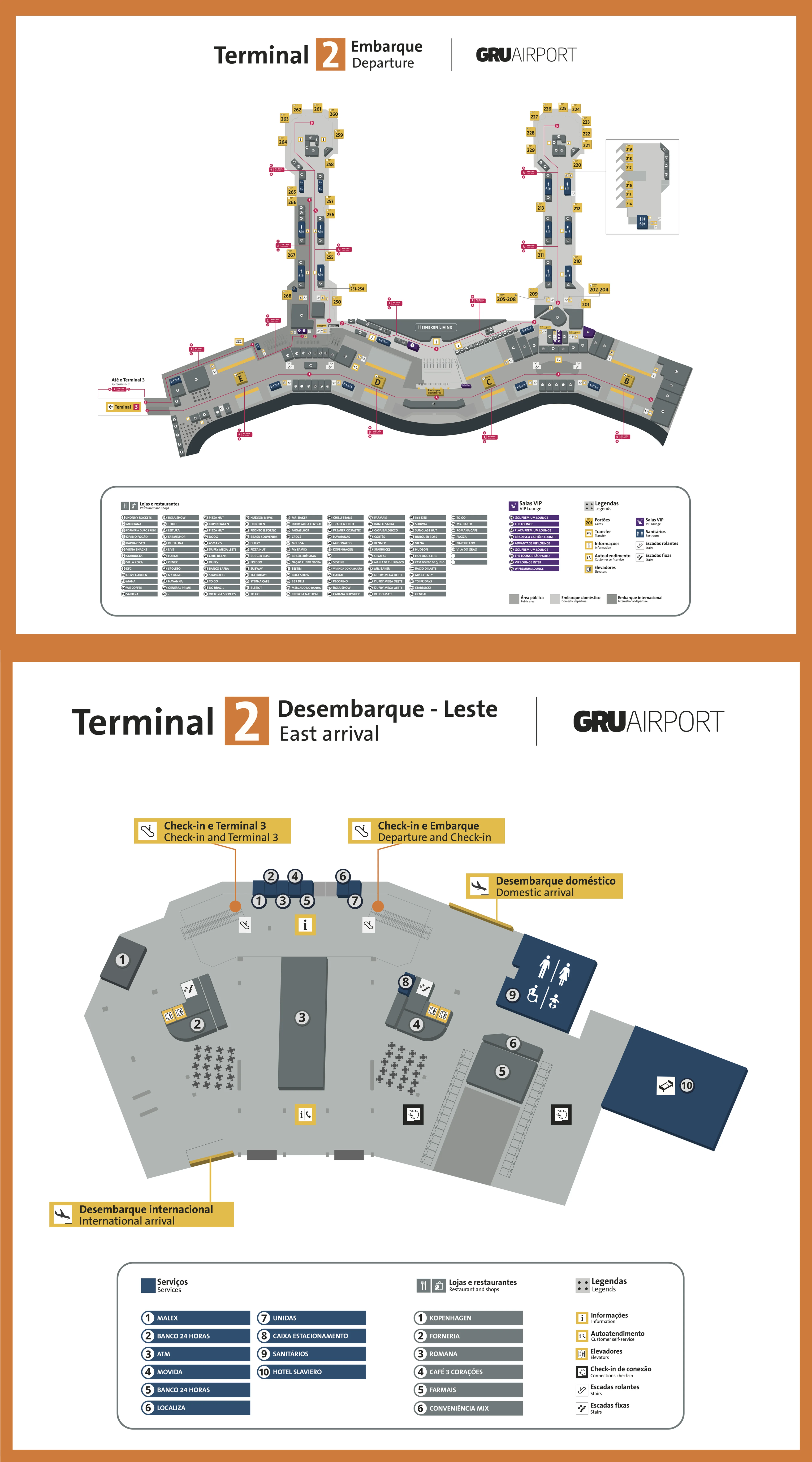
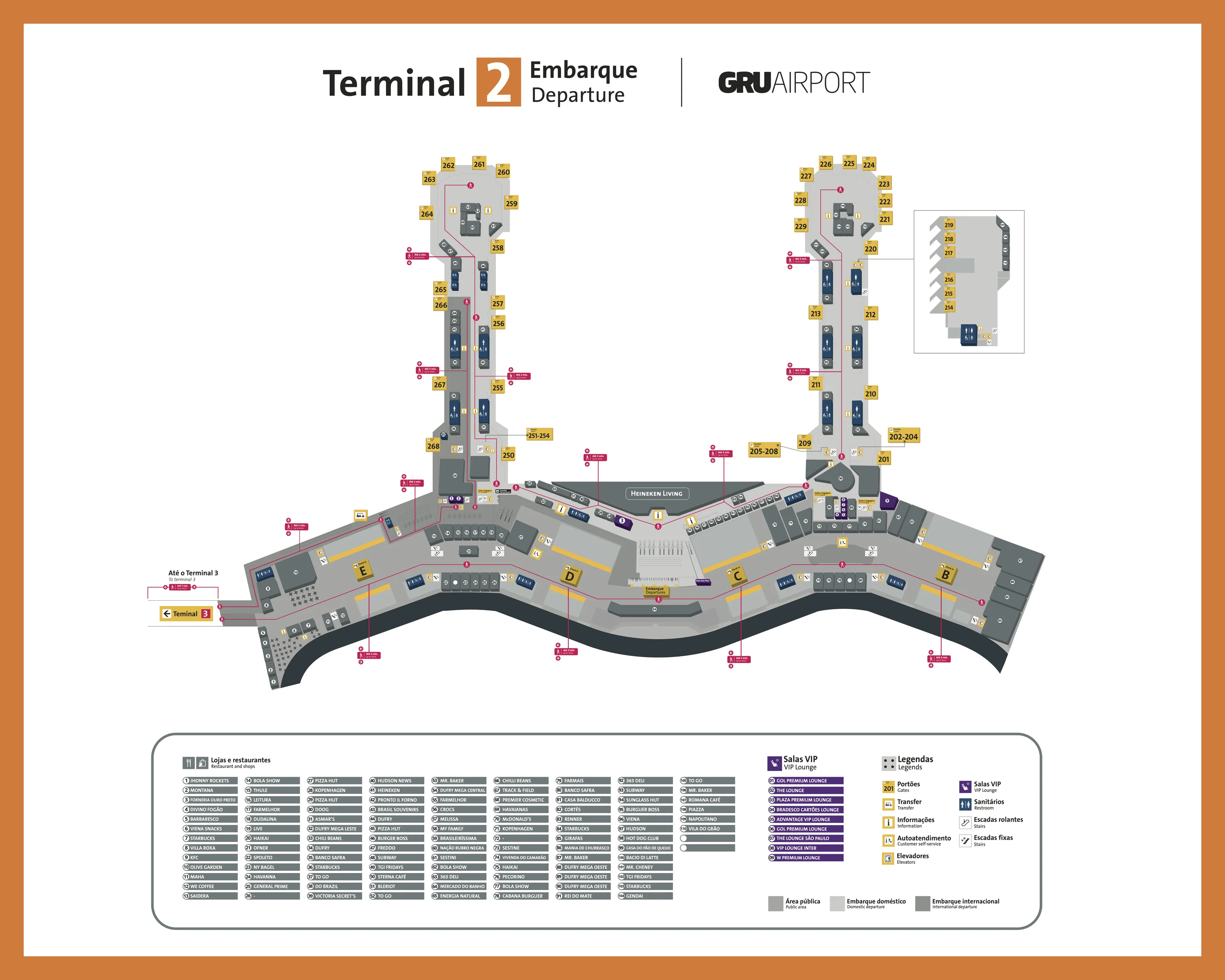
Terminal 2 at GRU is a long, two-pier building with a central processor, split into a West Pier (Gates B / 200-series) and an East Pier that points toward Terminal 3. The complex runs roughly west–east, with Arrivals on Level 1 and Check-in/Security/Departures on Level 2. Within São Paulo’s primary aviation hub, most “missed-connection” risk comes from level changes, long concourse walks, and the East-end linkage toward Terminal 3.
Map Table
| Zone | Connection | Walk Time |
|---|---|---|
| Central processor (Check-in B–E) | Domestic security (central) | < 5 min |
| West Pier (Gates B / 201–229) | Bus gates 201–205 (lower level) | 3–5 min (vertical) |
| East Pier (T2 far east end) | T2↔T3 footbridge entry | 5–7 min |
| Arrivals curb (East / West landings) | Intercity coach island sidewalk (East Landing) | 2–3 min |
São Paulo Guarulhos International Airport Terminal 2 Map Strategy
- Start by choosing your fork: T2↔T3 footbridge for airside transfers (East end, Level 2) vs the landside walk/shuttle after you exit arrivals; mixing them forces extra re-screening and time loss.
- Treat “post-customs → baggage recheck → terminal move → security” as one chained sequence; the fastest path depends on doing the recheck immediately at Terminal 3 before you commit to the landside corridor to Terminal 2.
- Use map-verified distances, not intuition: West Pier (Gates 215–229) is a long run from central security, and bus-gate flights (201–205) add a vertical drop plus boarding friction.
- Pre-load essentials before entering amenity-sparse gate stretches; the safest plan is food/water/restrooms near the central mezzanine, then commit to the far pier so you don’t reverse-walk under boarding pressure.
2026 São Paulo Guarulhos International Airport Terminal 2 Map + Printable PDF
Terminal 2 remains the legacy “workhorse” building at GRU, and the active retrofit/modernization footprint makes wayfinding feel inconsistent between the central processor and the far piers. A printable 2026 map is most useful when it shows Level 1 vs Level 2 clearly, plus the West-Pier gate run-out and the far-east connector approach toward Terminal 3.
São Paulo Guarulhos International Airport Terminal 2 Arrival Map 2026
São Paulo Guarulhos International Airport Terminal 2 Departure Map 2026
2026 São Paulo Guarulhos International Airport Terminal 2 Map Guide
What is the exact walking distance (meters) from the Terminal 3 international arrivals exit point used for transfers to the Terminal 2 domestic check-in hall?
The walking distance is about 1,000 meters from the Terminal 3 international arrivals exit (post-customs) to the Terminal 2 domestic check-in hall. The path starts at Level 1 in Terminal 3 after the duty-free/customs exit, follows the signed landside corridor toward Terminal 2, then ends by going up to Level 2 to reach check-in Zones B, C, D, or E.
A practical way to “lock” the endpoints is to measure from the Terminal 3 public arrivals hall doors immediately after the duty-free exit to the first Terminal 2 check-in bank entrance on Level 2 in the East Wing (then add extra lateral distance if you must reach a specific wing like D/E). Typical walk time is 15–20 minutes, mainly because of the level change and the long lateral traverse inside Terminal 2.
Where is the Terminal 2 entrance to the Terminal 2↔Terminal 3 pedestrian connector (footbridge)—which level and which end of the building?
The Terminal 2 entrance to the Terminal 2↔Terminal 3 footbridge is at the far eastern end of Terminal 2 on Level 2 (the boarding/departures level). The entry sits at the East Pier side of the Terminal 2 airside area, beyond the central processor, where signage typically points to “Transfer entre Terminais” and “Terminal 3.”
This is the wrong place to hunt if you’re still landside in the check-in hall: the connector is meant for passengers already inside the secure perimeter, so you reach it by clearing Terminal 2 security first and then walking east along the concourse toward the East Pier. If you start in the West Pier (Gates B / 200-series), budget a full end-to-end traverse of Terminal 2 before you even step onto the bridge.
Where is the baggage recheck drop-off area located on the post-customs path (the exact position relative to arrivals/duty-free exits)?
The baggage recheck drop-off counters sit directly after Terminal 3 customs, immediately beyond the final duty-free exit, before you spill into the public arrivals hall. The location is on Level 1 (Arrivals) and is positioned in the “last corridor” between customs clearance and the landside arrivals doors.
After you clear customs, you pass through the final duty-free funnel and enter the open arrivals circulation. The recheck desks are placed right in that transition zone, within roughly 50 meters of the customs exit, so you encounter them before you can drift toward the Terminal 3 arrivals curb or the landside corridor to Terminal 2. If you miss this drop, the next workable option is carrying bags to Terminal 2 and re-entering the standard check-in lines for Zones B–E.
What is the walking distance from Terminal 2 security screening to the farthest “B” gate zone referenced as having limited food options?
The walking distance is roughly 700 meters from the Terminal 2 domestic security exit to the farthest point in the “Gates B” zone (the west-end Gate 229). The route stays on Level 2, turning west after the central security checkpoint and following the long retail corridor into the West Pier.
Distance varies by your exact security lane exit and the specific gate (the zone spans roughly Gates 201–229), but the “amenity-thin” stretch is most noticeable once you’re past about Gate 215, with the far end requiring an 8–12 minute walk at normal pace. Use the central security exit as your start node, not check-in, because the biggest time sink is the uninterrupted westbound run-out after screening.
Where are the Terminal 2 “bus gate” holding rooms located (the specific gate/door cluster used for remote stands)?
The bus-gate holding rooms are clustered at Gates 201–205 at the western end of Terminal 2. The holding area is reached by dropping down from the main departures concourse on Level 2 to a lower-level waiting zone (Level 1), then continuing to the bus-boarding level (often described as Level 0) when the gate call opens.
From the West Pier entrance on Level 2, follow the flow toward the low-numbered 200-series gates and look for the escalators/stairs that funnel passengers down into the holding rooms. The most reliable adjacent landmark in this area is the W Lounge Guarulhos airside near the 201–205 cluster, which sits close to the vertical circulation that feeds the bus-gate rooms.
After clearing Terminal 2 security, what is the closest food-and-water concession to the “Gates B” area (by exact location on the concourse)?
The closest food-and-water concession is 365 Deli on the West Pier near the Gates B run toward the far end (the 220–229 side). Rei do Mate is another nearby quick option on the same West Pier corridor, but both are “snack-level” stops rather than a full food court.
If you triangulate from the far-west anchor (Gate 229), 365 Deli sits about 200–300 meters back along the West Pier on Level 2, making it the nearest dependable place for bottled water and grab-and-go items once you’re committed to Gates 215–229. For fuller meals, the practical boundary is the central mezzanine area—expect a much longer backtrack (on the order of ~500 meters) compared with staying near 365 Deli/Rei do Mate.
Where is the Terminal 2 domestic “Fast Pass” access point (exact placement in departures relative to the main security queue)?
The Terminal 2 domestic Fast Pass lane is at the central domestic security checkpoint entrance on Level 2, positioned directly alongside the main security queue. The access point sits in the departures/check-in hall flow, so you encounter it at the same “front door” where the standard line begins.
Look for the dedicated lane markings and Visa Infinite branding at the security entry, typically on the edge of the main queue rather than deeper inside the screening area. The most consistent landmark reference is the main Domestic Security Entrance serving the B–E check-in zones (near the D/E side of the central processor), where the general line often spills back into the hall during peak waves.
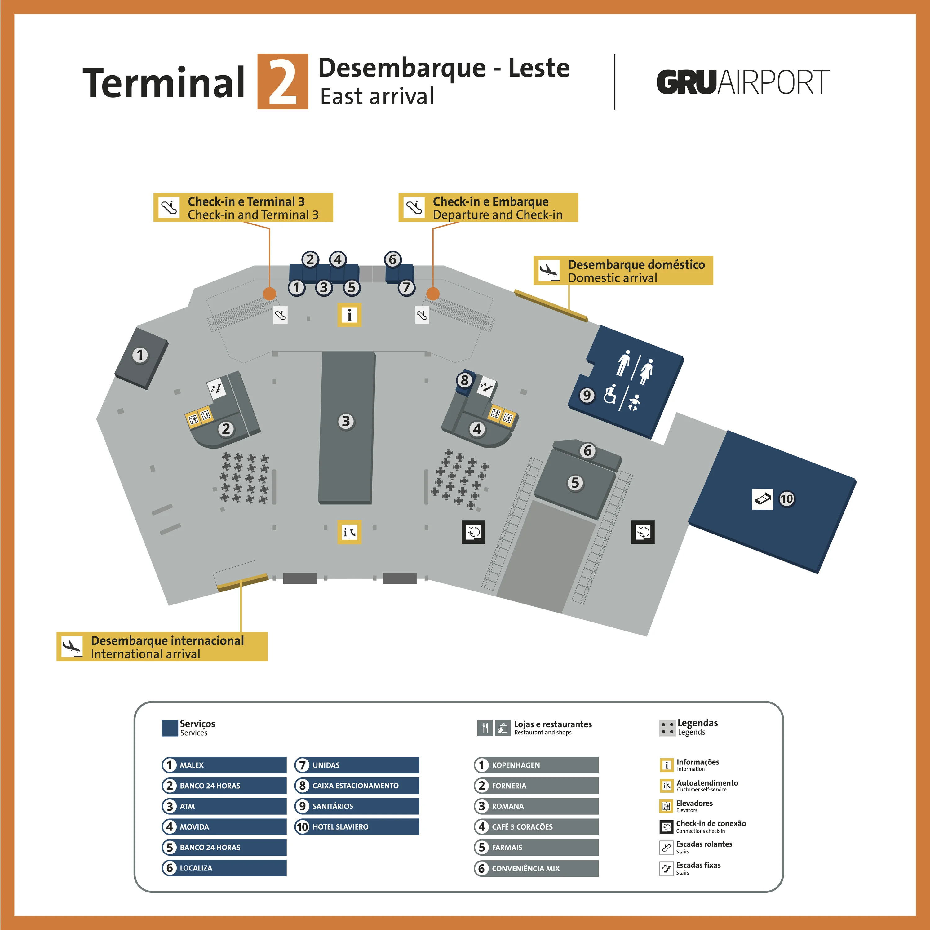
What is the exact route (and crossing point) from Terminal 2 arrivals to the landside bus stops used for São Paulo coaches—where do you cross the roadway?
The route crosses the first inner roadway directly outside Terminal 2 East Landing to reach the island sidewalk where the intercity coach counters and stops are. The walk starts at Level 0/Arrivals, exits the East Wing arrivals doors, then goes straight across the nearest traffic lane to the bus-terminal island.
| Segment | What to follow | Anchor point |
|---|---|---|
| Arrivals exit → curb | Exit Terminal 2 Arrivals (East Wing) to the curb | East Landing arrivals doors |
| Curb → crossing | Cross the first inner roadway to the island sidewalk | “Terminal de Ônibus” / Bus Terminal signs |
| Island sidewalk → stops | Walk to the coach counters and bays | Lirabus / Viação Cometa / Pássaro Marron counters |
Where is the Terminal 2 airside entry point for the T2→T3 airside connection that requires a boarding-pass scan (exact position within T2 domestic area)?
The airside entry point is in the Terminal 2 East Pier area on Level 2, where a boarding-pass scan checkpoint gates access into the pedestrian footbridge toward Terminal 3. The node sits airside (post-security), so you reach it by staying inside Terminal 2’s secure departures concourse and walking east toward the end of the building.
Follow “Conexão Internacional” / international connection signage through the East Pier until you reach the controlled access point that checks for a Terminal 3 international boarding pass. After the scan, you enter the glass-walled connector bridge and arrive at Terminal 3’s mezzanine level, where transfer passengers typically face passport control and a secondary security screening before reaching the Terminal 3 duty-free/departures circulation.
Where is the Terminal 2 rideshare/taxi pickup zone located (exact curb/door area) to avoid being routed to the wrong pickup point under time pressure?
The pickup zone is on Terminal 2’s Arrivals curb (Level 0) immediately outside the exit doors, with official taxis in the first lane and rideshare (Uber/app pickups) in the second lane or marked pickup bays. The critical placement detail is whether you exit at the East Landing or West Landing doors, because drivers often stage on the matching wing.
From inside arrivals, pick your wing first (East vs West), then step out to the curb: Guarucoop taxi counters/stands anchor the official taxi area closest to the building, while rideshare pickups are typically one lane farther from the doors. If you’re under time pressure, confirm the wing in-app before you walk outside, because switching between East and West landings is slow once you’re on the roadway side.