Dallas Fort Worth International Airport Terminal E Map (Most Up-To-Date)
Terminal E is a crescent-shaped concourse with a detached satellite gate block (E22–E30) that functions like a second mini-terminal reached only by a tunnel at Gate E21. Within North Texas’s main airport hub, the main gates run along the horseshoe, while the satellite sits out on the ramp, perpendicular to the concourse. Expect “gate numbers” to mislead you—your real navigation pivots around Skylink stations and the E21 tunnel junction.
Map Table
| Zone | Connection | Walk Time |
|---|---|---|
| Main Concourse (E2–E18) | Skylink North station (near E10) | E10 → E21: ~11 gate intervals |
| Tunnel Junction (E21) | Satellite tunnel down-ramp (escalators/elevators) | E21 → E22: 5–8 min |
| Satellite Concourse (E22–E30) | Tunnel only (no Skylink access) | E22 → E30: 3–5 min |
| South Concourse (E31–E38) | Skylink South station (near E35) | E35 → E21: 6–8 min backtrack |
| Security Node (E18) | Door E20 landside alignment | Checkpoint E18 → E21: <2 min |
Dallas Fort Worth International Airport Terminal E Map Strategy
- Treat E22–E30 like a separate terminal: budget 17–20 minutes from a Skylink drop-off to Gate E30 (backtrack + tunnel + satellite walk).
- Make Gate E21 your compass point: from Skylink, ignore “gate-number logic” and walk to E21 first, then commit to the tunnel sequence.
- Use the security shortcut on purpose: Door E20 → Checkpoint E18 positions you closest to the E21 tunnel junction for satellite departures.
- Avoid the “train + surprise walk” trap: the E35 Skylink stop fits the numbering system, but the backtrack to E21 is the time sink that breaks tight connections.
2026 Dallas Fort Worth International Airport Terminal E Map + Printable PDF
In 2026, Terminal E’s defining feature remains the E22–E30 satellite “island” reached via the Gate E21 tunnel, with no Skylink station at the tunnel mouth. Skylink access still clusters at the ends (near E10 and E35), and security choice continues to determine whether you face a long concourse hike or a near-direct shot to the tunnel—especially if you’re targeting the E18 screening area.

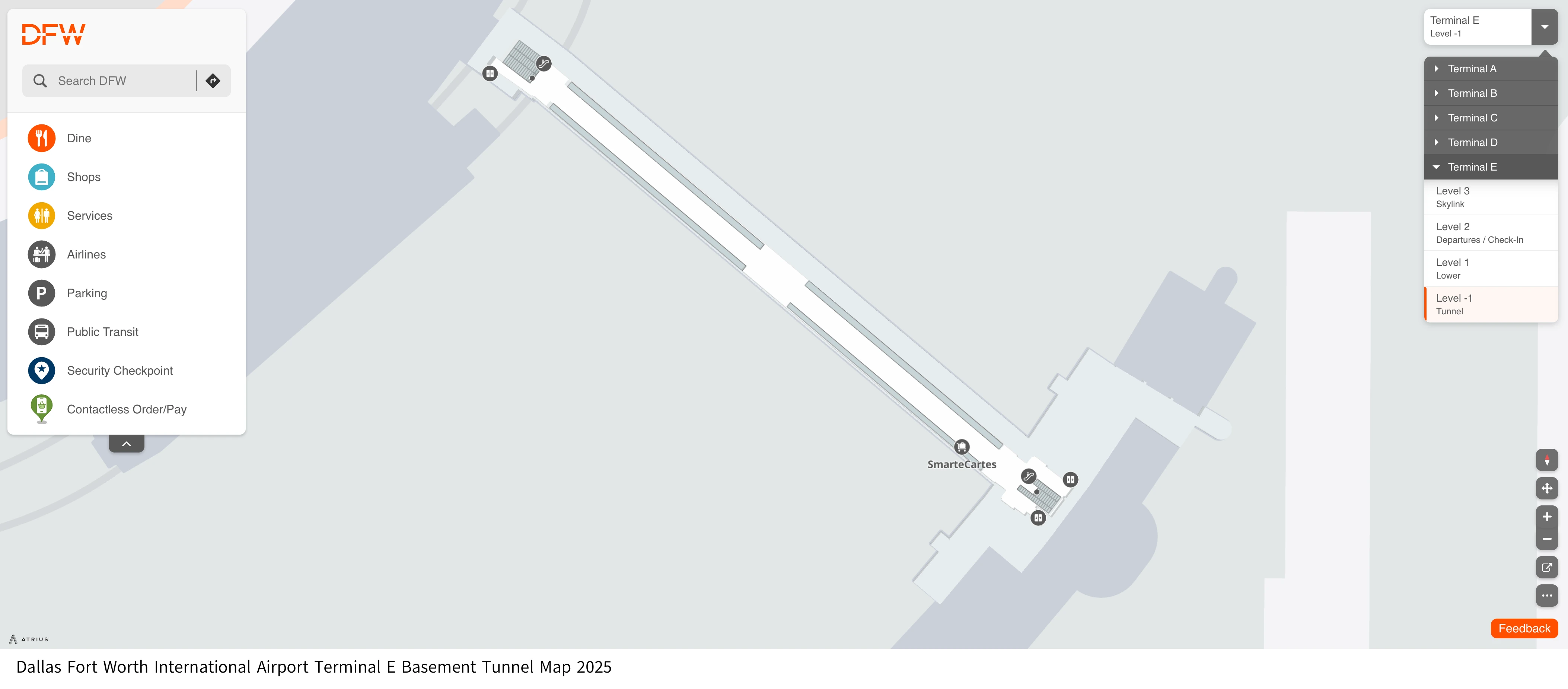
Dallas Fort Worth International Airport Terminal E Basement Tunnel Map 2025
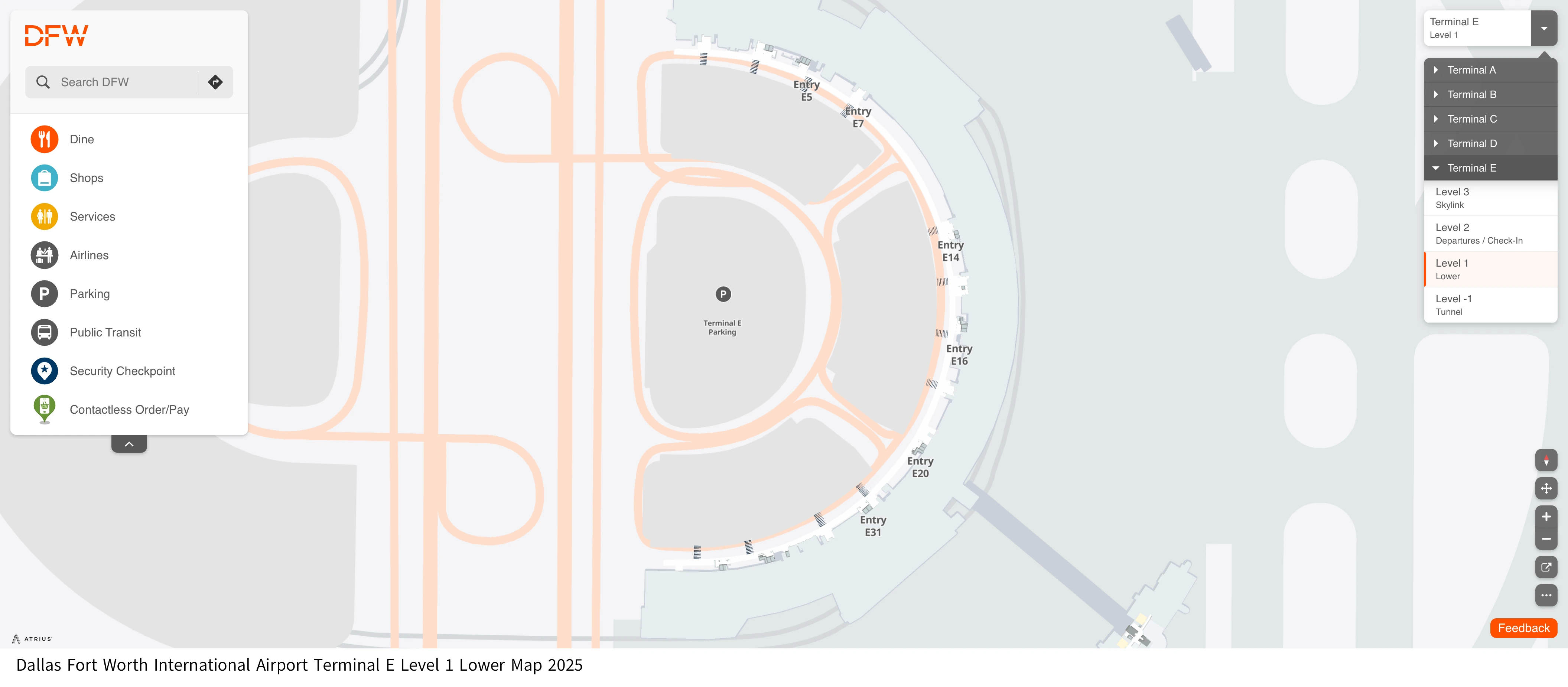
Dallas Fort Worth International Airport Terminal E Level 1 Lower Map 2025
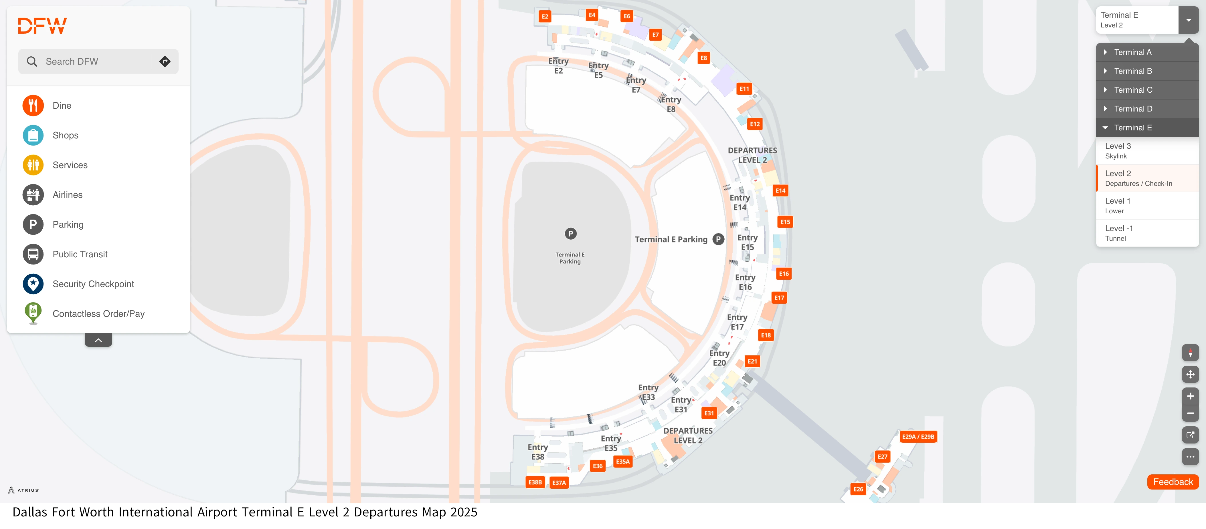
Dallas Fort Worth International Airport Terminal E Level 2 Departures Map 2025
Dallas Fort Worth International Airport Terminal E Level 3 Skylink Map 2025

2026 Dallas Fort Worth International Airport Terminal E Map Guide
Which Skylink station in Terminal E is closest to the E-satellite gates (E22–E30)?
The Skylink station near Gate E10 is the closest mapped station to the E-satellite (E22–E30) because it has the shorter concourse walk to the Gate E21 tunnel junction. The E35 station is the one most people take because signage groups “E20–E38” together, but it typically forces a longer backtrack before you even reach the tunnel.
| Route decision | What you do | What it optimizes | Typical penalty |
|---|---|---|---|
| Skylink to E10 (North station) | Exit near E10/E11 → walk to E21 → tunnel to satellite | Shortest station-to-tunnel distance | Still a long hike to E21 |
| Skylink to E35 (South station) | Exit near E35/E36 → backtrack to E21 → tunnel to satellite | Matches gate-number signage logic | Longer backtrack (highest miss-risk path) |
What is the walking time from the closest Terminal E Skylink drop-off point to Gate E30 via the tunnel?
Walking takes about 17–20 minutes from the closest practical Skylink drop-off to Gate E30 because you must combine a concourse walk to Gate E21, the E21 tunnel transit, and the satellite walk from E22 to E30. The time loss is rarely the train ride—it’s the “backtrack + tunnel + satellite” sequence after you exit Skylink.
| Segment | Start → End | Typical time | Adjacent landmark cue |
|---|---|---|---|
| Concourse reposition | Skylink station (near E35/E36) → Gate E21 | 6–8 min | Pass gates E34–E31 toward the terminal center |
| Tunnel transit | Gate E21 → Gate E22 | 5–7 min | Tunnel spur beside Gate E21 with “Gates E22–E30” signage |
| Satellite walk | Gate E22 → Gate E30 | 3–5 min | Straight run through the detached satellite building |
| Total | Skylink drop-off → Gate E30 | 17–20 min | E21 is the pivot point, not “E30 signage” |
Where is the tunnel entrance to the E-satellite (E22–E30) located relative to Gate E21?
The tunnel entrance is immediately adjacent to Gate E21 on the main Terminal E concourse, marked by signage for “Gates E22–E30” that diverts you off the windowed gate hallway into an inward corridor. The entrance area funnels you toward escalators and elevators down to the connector level, so if you can see Gate E21, you are essentially at the only access point to the satellite.
Which Terminal E Skylink station is mapped closest to Gate E21 (the satellite tunnel junction)?
The Skylink station near Gate E10 is mapped slightly closer to Gate E21 than the Skylink station near Gate E35 because it requires fewer gate intervals along the concourse to reach the E21 tunnel junction. The E35 station remains the default for many travelers because wayfinding groups higher-numbered gates together, but the geometry still forces a longer backtrack to E21.
| Skylink station | Concourse walk to Gate E21 | What it feels like on foot | Landmark cue |
|---|---|---|---|
| Near Gate E10 (North) | ~11 gate intervals | Long, but marginally shorter | Walk past E11–E18 toward the center |
| Near Gate E35 (South) | ~13–14 gate intervals | Longer backtrack, often crowded | Walk past E34–E31 toward the center |
What is the walking time from Gate E21 (tunnel junction) to Gate E22 (first satellite gate)?
Walking takes about 5–8 minutes from Gate E21 to Gate E22 because the route includes a level change down from the concourse, the full connector tunnel under the taxiway, then a level change back up into the satellite building. The biggest variable is the vertical transitions (waiting for elevators or pacing on escalators) plus whether the moving walkways in the tunnel are running.
- 1–2 minutes for descending/ascending via escalators or elevators near the E21 spur
- 3–5 minutes for the tunnel walk itself (pace and moving walkway status)
- ~1 minute for re-orienting at the satellite end where Gate E22 begins
Where exactly is the CLEAR checkpoint in Terminal E (relative to E16/E20) on the terminal layout?
The CLEAR checkpoint is at Security Checkpoint E18, which is accessed landside from Door E20 and feeds you airside near the E18 gate area. That Door E20 → Checkpoint E18 offset is the key map detail: you enter at E20 on the curb, but the screening exit places you closest to the Gate E21 tunnel junction for Gates E22–E30.
Which Terminal E security checkpoint has the shortest mapped walk to the nearest Skylink escalators/elevators?
Checkpoint E8 has the shortest mapped walk to Skylink because it exits closest to the North Skylink access point near Gate E10. If your plan is “clear security in E, then immediately take Skylink to another terminal,” E8 minimizes the post-screening dash to the escalators/elevators.
- Checkpoint E8 → Skylink access near Gate E10: about 2 gate intervals (under ~2 minutes)
- Checkpoint E18 is the opposite tradeoff: best for the E21 satellite tunnel, but a longer walk to either Skylink station
- Checkpoint E33 is closer to the E35 station, but hours/capabilities are less reliable than using E8 for speed-to-train moves
Where is the nearest elevator to access the Terminal E Skylink platform from the concourse level (for mobility-limited travelers)?
The nearest elevators to the Skylink platform are the elevator banks co-located with the two Skylink station entrances: one by Gate E10/E11 (North station) and one by Gate E35/E36 (South station). The critical constraint is that there is no elevator access to Skylink near Gate E21, so satellite travelers (E22–E30) must return through the E21 tunnel junction and then roll or walk the full concourse distance to either E10 or E35 to reach an elevator up to Skylink.
Which Terminal E curbside entry is closest to the Terminal Link shuttle pickup for travelers transferring terminals outside security?
The closest curbside entries to Terminal Link in Terminal E are Door E12 for the north-side stop and Door E34 for the south-side stop, because Terminal Link pickups operate on the Upper Level (Departures) at those two points. If you’re coming from baggage claim, the move is vertical first—take an elevator up to Level 2—then exit at the door that matches your intended Terminal Link stop.
| Terminal Link stop | Closest curbside entry | What it serves | Adjacent landmark cue |
|---|---|---|---|
| North stop | Door E12 (Upper Level) | Gates E2–E18 side | Between the E8–E11 area |
| South stop | Door E34 (Upper Level) | Gates E20–E38 side | Between the E31–E32 area |
Which Terminal E baggage-claim exit door is closest to the primary rideshare pickup location?
Walking is shortest when you exit from the Upper Level door that aligns with your baggage-claim position because rideshare pickup operates along the Upper Level curb rather than a single fixed “one-door” point. After you collect bags, the map-critical move is to go up to Level 2 first, then use the nearest elevator bank to reach the Door number closest to your carousel zone (for example, a claim area around E15 aligns best with nearby Upper Level doors like E16/E18 for less lateral curb walking).
If an arriving flight is bussed to a different terminal than expected, where is the passenger drop-off point mapped relative to that terminal’s main arrivals exit?
The bus drop-off is mapped at Terminal D on the Lower Level near the terminal’s central arrivals axis, aligning with the Customs/International Arrivals-side exit area rather than Terminal E baggage claim. In practice, that means a “Terminal E” hardstand arrival can physically surface at Terminal D’s main lower-level arrivals flow, so meet-ups planned at Terminal E will fail unless the pickup relocates to Terminal D or the passenger takes Terminal Link from D’s Upper Level to reach E.